Tuesday, July 31, 2018

New experience!


We mentioned that when we were in Katmai National Park, the immense brown bears didn’t seem to follow the rules at all, walking on the visitor paths, muscling in on the fishing holes of those fly casting in the Park, and generally making havoc. Apparently in Anchorage proper they don’t put up with any of that nonsense at all. Not only do they expect the local moose population to follow the rules, they also expect that they can read and interpret signage.

Before leaving the area, we drove then entire 14 miles of the Alaska Peninsula Highway between King Salmon and Naknek. King Salmon is the salmon sport fishing capital of the world. Apparently Naknek is the commercial salmon fishing capital of the world and is 5 times the size of King Salmon. Of course, that still means its year-round population is well under 500. Just for a flavor of the area, we lunched at the best restaurant in town. We got lucky and managed to be in King Salmon and Naknek for their annual Fishtival weekend, so we got to see some of the doings.
Living in RV parks we have become used to seeing new and interesting things all the time. The ingenuity of some folks carrying their homes with them on wheels astounds. While I know that necessity is the mother of invention, I have to admit I have never seen someone take a trailer that had a bad undercarriage, and just put it on top of another flatbed trailer. Works I guess!
Before we head out, I have to say I am still amused by the road names in Alaska. We are heading for a new adventure to Nome and will be gone for several weeks. We will be boarding an ice breaker, heading into the heart of the Bering Sea, and visiting several ports in Siberia. We will be signing off for a bit, but will pick up where we left off when we get back.

Talk to you soon!

Saturday, July 28, 2018

Katmai National Park

We had wanted to visit Katmai National Park back in 2010 when we were here, but we could not fit that in. Now being back in the area, we jumped at the chance. However, it’s not simple – the Park can only be reached by air. There are no roads leading to the park at all.

We got a huge bonus totally by luck. Katmai was established as a National Monument by Woodrow Wilson on May 26, 1918. The Park is larger than the state of Connecticut. The Monument was originally established to protect the area around the major 1912 volcanic eruption of Novarupta, which formed the Valley of 10,000 smokes. The Park contains no fewer than 18 individual volcanoes, 7 of which have been active since 1900.
The main reason that folk visit Katmai today is that Brooks Creek is the main route for salmon from the Bering Sea to get to their spawning grounds. Because of that, Grizzly bears flock here during the salmon runs in order to fatten up for the winter. While Grizzly bears in the interior US feed on berries and small mammals, those in the coastal areas feed primarily on salmon. The high calorie count of the salmon and the abundance during the run make for a buffet for the brown bears.
We were stunned when we got here. We have been to areas that were magnets for brown bears before, but we have never seen so many. Every time we ventured to the creek we saw anywhere from 9 to more than a dozen very large grizzlies. And they were feasting – we’ve read that brown bears need to eat around 10 salmon a day in order to gain the fat needed for hibernation. We are certain that these bears were getting more than their 10 a day quota.
We experienced s good news – bad news scenario. The good news is that there are lots - I mean LOTS of bears around. The bad news is that bears don’t necessarily follow the National Park Service rules. The bears tend to think that the slightly cleared paths that the visitors use to get around the Park are a nice, easy way for them to get around. Because of this, human/bear encounters happen. And they happen more the more bears are in the area. We actually shared our path with 1,000 pound brown bears several times – yikes!
There is only a foot bridge over the bay that gets you across to the main paths to the bear viewing areas. If bears are around the foot bridge, the Park Rangers close it to protect the visitors. However, the bears could care less about this inconvenience. When the number of bears is high, the incidence of the foot bridge being closed is high.
The Park rangers record the bears in the area. They do it all visually – they don’t try to tag the bears or anything electronic. But through their observations, they have a pretty good record of the brown bears that fish here. Each bear definitely identified is numbered, and a few of the more interesting or photogenic bears are named. Our favorite was 747, or Lefty. Lefty was easy to find due to a patch of missing fur the size of a dinner plate on his right hip. Also, Lefty took a position he alone owned on the top of the falls, where salmon literally jumped into his gaping jaws.
The goal is simple – eat as many salmon as you can to gain enough weight to live through your next winter hibernation. So, the big, mean bears got all the choice fishing spots up near the falls where the salmon were continually jumping. Moms with cubs would find lesser desirable places to fish, sometimes just eating the carcasses that washed downstream from the main event. They did this in part so they didn’t have to mess with the bigger males for choice fishing. They also did this because the big males were indifferent between getting their needed calories by eating a salmon, or a cub brown bear!
We learned that grizzlies were solitary, usually only to only tolerate only one bear in say a square mile. But, they willingly abandon those rules to participate in the smorgasbord that is the salmon run. Young adult bears – teenagers – pretty much at this point in their life cycle are looking for a safe place to call home. Finding it easier to do that search with someone covering your back, they often will pair up with another young adult bear who is not a sibling and do the search together.

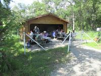
I have never been anywhere I can remember where the picnic tables for Park visitors were surrounded by electric fences. This seems like an extreme measure, however given that the bears don’t seem to understand the rules at all, or if they do they don’t follow them, I guess it totally makes sense. The Woman found out the hard way that even the outhouses inside the Park are outlined with electrified strands of wire.
We loved our time at Brooks Camp and Brooks Falls. We couldn’t have asked for more in terms of bear count. In addition, the whole experience of flying into communities that were only accessible by water or by air was fun. Flying out each morning in a light plane to see the bears, and back each night to a very cozy and warm King Salmon Lodge was a fascinating experience.
Talk to you soon!

Wednesday, July 25, 2018

Anchorage revisited

The roadway to Anchorage was stunningly bad. We had experienced roads far north around Fairbanks last time we were in Alaska with Colectiva, but not this far south. At first, we assumed that perhaps it was because we were earlier in the season, and maybe Alaska DOT had not yet been able to get to all the winter frost damagee. But we later learned that in May of last year the region was hit by a 5.2 earthquake, and the damage was a result. Locals complain that the state has received federal funds resulting from the earthquake, but just hasn’t spent that money to repair their roads.

I had mentioned that most of the towns we visited in the Aleutians had year-round populations well under 100, and the ferry maybe only stops monthly. Locals are so happy when the ferry stops, even through it is only for a half hour or so, that they treat the ferry passengers that stroll through town to a feast. This guys daughter spent the prior day cooking up all these baked goods and laid them out for any and all to enjoy – gratis!
The fishing theme is everywhere. Not only are there boats and nets and ship paraphernalia all over wherever the town gets close to the water, but nearly all the homes in the area are boldly decorated with nautical themed doodads. They actually seem to be in competition as to who can look the most nautical.
And even if a homeowner decided that a fishing or ocean theme is not to his or her liking, then there is also the wildlife or hunting themes that go well. This home combined both land based and water-based wildlife in his or her decorations.
I am not quite sure what these guys are up to. Are they of the opinion that if they can’t see you that you can’t see them – i.e. are they hiding from us? Or is there just something really fascinating under the surface of the water that we can’t see? Or is the water shallow and there are all kinds of superior food stuff on the bottom? Who knows!


I am not sure they can blame the condition of this bridge or pier – not sure which it was originally meant to be – on the earthquake. I think that it is just a function of lack of maintenance, and the harsh elements it has to contend with. I bet the locals don’t use this one any more.
In most US cities they name their roads for past presidents, or important historical characters. Sometimes roads are named for people who played a key role in the development of the city or the region. In Alaska, they don’t seem to do that.
Talk to you soon!

Sunday, July 22, 2018

The isolated islands

After Kodiak, we hit a series of communities that essentially rely on the ferry for vital supplies. Here’s the stops and the populations – Old Harbor, 218 – Sand Point, 976 – King Cove, 939 – Cold Bay, 10 – False Pass, 35 – Akutan, 1027 – and finally Dutch Harbor, 4,376. Some of the stops were in the wee hours of the morning, so many times I had to go ashore on my own. Did I mention it was cold?

In my opinion, the visits were always fun, even if not at the ideal time for touring. There was not much to see at most of the stops, but we hit on a bonanza in Kings Cove. I wandered on shore, again all on my lonesome, I stumbled on the Saga. The Saga was the ship that was one of the primary subjects of the Discovery Channel reality series Deadliest Catch. We had also bumped into the homestead of the Kilchers, subjects of the reality series The Last Frontier. I guess Alaska is ripe for reality programs.
We finally made it to Dutch Harbor, the farthest east that the Alaska Ferry system travels. Dutch Harbor lies actually on the Bering Sea rather than the Pacific Ocean. As such it was cold and just a bit hostile. But we learned a great deal. For starters, we found the oldest Russian Orthodox Church in America – the core built in 1825.
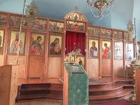
We checked out the church and it was all locked up, but I noticed that the next day at 10 AM there was a service scheduled. So, we showed up at 10 the next day, and were rewarded with a look at the inside (almost identical to the one in Kodiak). But we also got a major bonus – a pair of what looked like sibling Red Fox were frolicking in the church yard. We literally watched them play and fake fight for maybe a half hour – magical!
We were stunned that there were bald eagles all over the place. As we drove around town there seemed to be an eagle perched on every 4th or 5th light pole. They were on most roof tops, and even just perched on high ground, or a post sticking out of the water. The locals just said “You should see how many are at the landfill.”, so they weren’t all that impressed. We were in awe.
We were told there were whales around as well. A nice lady at the rental car office said she had just moved here recently from coastal Oregon. She said she had never seen a whale in her life until moving here, and now she sees them almost daily. We didn’t get that lucky, so had to settle for some sea otters – not too bad eh?
We learned a lot about how our government treated the Aleuts during WWII. The Aleuts occupied most of the Aleutian Islands when the US purchased Alaska from Russia in 1867. As a result of the purchase, they became American citizens.  However, on June 6, 1942, Japanese troops invaded Attu and Kiska Islands, the first occupation of US territory since the War of 1812, taking many Aleuts prisoner. In response, the government began a forced evacuation of Aleuts from other Aleutian Islands, including Dutch Harbor. The evacuated Aleuts were housed essentially in internment camps in horrible conditions. It has been documented that the death toll in Aleut internment camps due to poor conditions and lack of care were as high as those in prisoner of war camps where US soldiers were detained.
And, it wasn’t just forced evacuation to horrifying conditions. The US Department of Interior had discovered it could fund much of its budget by harvesting seals in the Aleutians. Interior coerced the Aleuts to hunt seal for them and paid them the going wage – around $45 for the entire hunting season! Now, that wouldn’t constitute slave labor since they were actually being paid, right? So much for what US citizenship gets you.
So, Attu and Kiska were invaded and held by Japanese troops. Not something I remember learning in history classes in high school. Dutch Harbor was heavily bombed by the Japanese, which is why some of the structures here in those days were built underground. The primary military hospital here was entirely underground, a complex of 3 massive buildings which served the needs of the military, as well as what was left of the town.
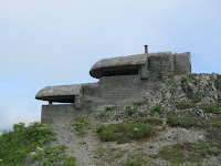
We visited the remains of Fort Schwatka. This fortification was built in 1940 and housed over 250 soldiers in 1942. Large guns and an immense number of munitions bunkers still dot the hills around Dutch Harbor.
Except for the concrete gun bunkers, nothing remains of the Fort. Built in 1940, it was essentially completely abandoned by 1948, and has been in a slow state of degradation since then. The concrete foundations of the staff barracks and officers’ quarters remain, but on top of them lie the scattered lumber of the structures that once stood.
That being said, some of the best views of Dutch Harbor and its idyllic location are to be seen from the abandoned portions of Fort Schwatka. I am really glad we ventured up here and witnessed where the war in the Pacific was actually fought on US soil.
So, Dutch Harbor is remote Alaska, with an Aleut heritage, and now primarily a fishing town. So we were surprised to find that the three main restaurants in town were – Dutch Harbor Restaurant, Chinese – Harbor Sushi, nuff said – and Amelia’s, Mexica. Huh! So, we finally found the place where all the fishermen hang out.


So, just a point of perspective. We have all heard about how the wage rate in Alaska is really good. As far as I can tell, that is true. But also, the cost of living here is astounding. Here is what the bill was for us to have some wine and two appetizers in Dutch Harbor. Sheesh!
Talk to you soon!

Thursday, July 19, 2018

Making our way to the Aleutians

The Aleutian Islands stretch from the tip of the Alaska Peninsula nearly to Russia. There essentially are no roadways in the Alaska Peninsula, much less bridges connecting the Aleutian Islands. So, the only way to get to them is by sea or by air. We decided to fly to Homer and catch the Alaska Ferry which is pretty much the commercial lifeline to the communities on the Peninsula and out in the Aleutians.

Since we hadn’t been in Homer for nearly 10 years we decided to see if any of our old haunts were still there. While a bit foggy, we were able to remember the feel of Homer, if not specific places. We hopped on a narrated trolley that circled town and got refreshed. However, we didn’t need the narrated trolley to remember this place – not a hang out for us back then, but how could you possibly pass this up?
We had almost 10 hours to kill in Homer between the arrival of our flight and the departure of the ferry. We thought we would book a room at the hotel next to the ferry dock, just to have a warm spot to relax and store our bags. But we didn’t consider Alaska in the short summer season – fully booked! At least they were willing to hold our bags while we strolled around town and didn’t even charge us! As the time of embarkation came, we spotted two possible ferry boats nearby that could be ours. Sadly, it turned out to be the small one in the foreground, the Tustumena, and not the larger one in the background.
Our first stop was one place I always wanted to visit, Kodiak Alaska. Kodiak is an island far south of the Alaska Peninsula in the North Pacific Ocean. With a population of over 6,000 it is the largest city due east of the mainland. This island had been inhabited by the Alutiiq for over 7,000 years before being overpowered by the Russians beginning in 1763.
There are only 4 Russian Orthodox Churches that still stand on American soil. One of them is in Kodiak. We saw it as the ferry came into town, and we managed to find our way through town to see it. While significantly updated during WWII era, it was still a strong connection to the Russian heritage of this region.
We got lucky. A cruise ship was in town. They opened up the church so the cruise ship passengers could get a glimpse inside. Since we were old and white, we blended right in with the cruise ship folk and nobody asked any questions. We thoroughly enjoyed the visit.
We also found what is now referred to as the Baranov Museum. Kodiak was really established as a Russian settlement in 1793. Originally built as a storage magazine in 1810, it is the oldest Russian structure in North America. Over the centuries it changed hands many times and was primarily used as a personal residence. It is now referred to as the Baranov Museum named after Alexander Andreyevich Baranov, chief manage of the Russian-American Company who built the structure.
The Kodiak National Wildlife Refuge was on our bucket list – not near the top, but on there. We visited the only Visitor Center for the Refuge which happened to be located near the ferry in the city of Kodiak - Bonus! Now out to the islands!
Talk to you soon!

Monday, July 16, 2018

On to Anchorage

From Chicken, we headed to Anchorage via Gakona Alaska. The mile house here was historic on its own account, but then in 1942, the US Army Corps of Engineers constructed additional buildings to serve the construction of the Alaskan Highway to help defeat the Japanese in World War II. Today these buildings serve as a restaurant and a tavern.

When we were in Alaska in 2010 we hadn’t yet learned about Pete Wolf Toth. It turns out that Toth’s gift to the state of Alaska was at the community college in Valdez, giving us a reason to make the journey to visit there once more. It was worth the long drive.
We had vague recollections of Valdez, but we didn’t really remember just how beautiful it is. You would swear you were in the Swiss Alps when you stand on the water’s edge in downtown Valdez. A well placed geocache got us out to the best view in town. We had a nice lunch at the Fat Mermaid not far from here, so took in this view while eating the locally caught halibut special.
We had been to several spots in Wrangell – St. Elias National Park, but somehow missed the Visitor Center. The largest National Park in the system, it boasts some amazing stats. The Park is larger than Yellowstone NP, Yosemite NP and Switzerland combined! 9 of the 16 highest peaks in North America are within the boundaries of the Park. It’s the home to the North America’s largest sub-polar ice field.
At this particular rest area with a spectacular view of the Wrangell Mountain Range we stopped to stretch our legs a bit, water the pooch, and see if there might just be a cache – often there is one hidden in a prominent rest stop. Well there was – and the Woman used her geo
sense to lift up this post cover to find it – nice job!
We will be in Anchorage for a bit visiting places we never made it to in 2010. We may be on and off on the blog front as we make our way by plane, ship and foot around western Alaska.
Talk to you soon!