Friday, September 15, 2017

Omens

We are 5 for 6 now. We made our way to Wind Cave National Park. Established by Roosevelt on January 9, 1903, it is one of the earliest National Parks in the US, and is the very first National Park established to protect a cave system. Actually, it is the first cave based National Park anywhere in the world. Wind Cave is believed to be the 5th longest cave system in the world, believed to be in that only maybe 5% of the system has been explored and mapped, and its length is estimated based on measurement of air flow in the cave.

We toured the cave. It is known for what is called boxwork – calcite worked its way into cracks in the limestone, and when the acidic water ate away the limestone, the thin, fragile filled cracks remained. The reason for the name is that folk believed it looked like the maze of post office boxes where they picked up their mail. Allegedly 95% of the boxwork discovered in caves in the entire world is here in Wind Cave.
Wind Cave is a dead cave – there is very little water seeping into the cave and creating features at this time. But the mission of continuing to explore the cave carries on. Each few months the length of mapped caves changes, adding miles each year to the known stretches. Like Jewel Cave we visited a few days ago, there are only two active entrances to Wind Cave, making the exploration of it challenging and slow.
Adjacent to Wind Cave NP is Custer State Park. We had high hopes given the claims about the abundant wildlife here. We did see one pronghorn antelope, some wild burros and many prairie dogs, the buffalo were in pens and not roaming freely, and we saw nothing that knocked our socks off. It still was a nice drive and worth the effort.
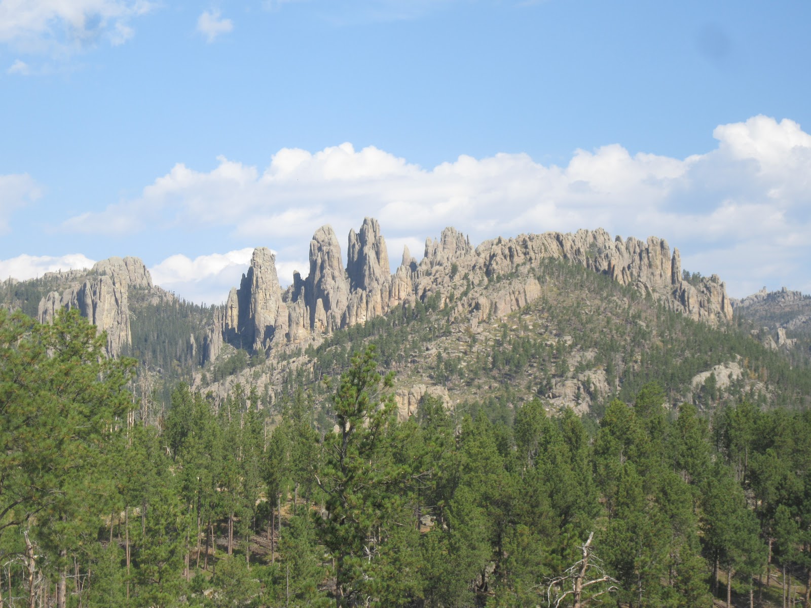
Our favorite was the Pinnacles Highway. We drove in and amongst the rock formations, with 10 MPH curves, white knuckle overhangs, and views galore. It was spectacular! At an average speed of 25 MPH, it took us a bit to wind our way through, but it was well worth the time and the tension.
So, we have been accused of being the jinxes that are causing all the wild fires in the West. We visited Glacier NP, and now it’s burning and they are evacuating folk. The same Is true of many of the places we have visited, but none before this is as eerie. We left Wind Cave NP around 1ish – at 2 PM the same day, they had a lightning strike that set off what is now a 300-acre wild fire, and is still not under any level of control. Maybe it is us!
Other omens – we found gnaw marks in the pooches’ food and other containe
rs. We set mouse traps and left them in various spots around the coach. The Woman didn’t hear the SNAP in the middle of the night, but I did. Hopefully, the other 5 traps I set out will yield no bounty.
Today’s road was not kind – when we drove to Alaska they warned us about porpoising on the ice heaves – in the Lakota land on the BIA (Bureau of Indian Affairs) highways, it was worse than Alaska. We made it in one piece – so we thought. When we opened up our slides, we heard CRACK CRUNCH and lost a closet door, as well as a smashed CD drive for our laptop. I guess it could have been worse.

Talk to you soon!

Wednesday, September 13, 2017

Custer South Dakota

We were here 23 years ago with Nick and Karen, but we must have stuck to the kid friendly attractions as there are several items of interest that have been here forever that we missed, as well as some I had wanted to check back on. I thought I was going to check in on the progress of the Crazy Horse Monument, but when spotted, it looked exactly to me like it did 23 years ago. I guess a close up inspect won’t be necessary.

The Crazy Horse Monument is being sculpted by the heirs of Gutzon Borglum, the man who is best known for sculpting the Mount Rushmore National Memorial. Since we just did a scenic road trip on our first day in the area, there was no reason not to do a drive by!
Setting our itinerary a year ago, I saw a small point on the Rand McNally atlas map indicateng that the geographic center of the United States was just North of Belle Fourche South Dakota. While not terribly close, we decided it was worth adding to our initial scenic drive.
In 1912 the US Geological Survey established a point about 3 miles Northwest of Lebanon Kansas as the geographic center of the US. It stood as that marker until 1959, when Alaska and Hawaii were made states. Admitting those states reset the geographic center of the US to where we headed today.
Not many folks ever go here. Since the highway that ran by the site was rerouted, a visit requires an 8-mile drive on a very remote dirt road. Luckily the farmer who owns the land has made sure that folk who want to visit are able. We hiked a bit out into his field and found the actual USGS marker positioned at the exact geographic center of the US. How cool!
Why we didn’t visit the nearby National Monument while we were here 23 years ago I can’t recall. Established by Theodore Roosevelt with many of his other Western monuments, is the Jewel Cave National Monument.
We toured this interesting cave, and learned that where we were walking likely didn’t exist last time we were here. Until relatively recently, the only touring of Jewel Cave was through the one and only surface opening that has been discovered in the first couple centuries of exploration. In the last couple decades, an elevator shaft was sunk into the center of some very large rooms that has resulted in visitors being able to visit some more spectacular portions of this massive cave system.
Jewel Cave is believed to be the 3rd longest system of connected caves in the world, at over 190 miles of explored caves. Mammoth Cave in Kentucky, which we visited last time we were out East, is the longest at over 400 miles of explored caverns. All of the 400 miles of Mammoth Cave have been explored, while perhaps less than 5% of the estimated 190 miles of Jewel Cave have been explored. The primary reason is that the Mammoth Cave system has been fully explored is because there are more than a couple dozen natural entrances that made exploration much easier.
There is only one in Jewel Cave, and luckily it was on the Canyon Trail we hiked. Having only one entrance meant that explorers would take days just to venture further into the cave system. Packing in and out everything they needed meant that their exploration ventures could only be 4 or 5 days in duration. What that means is that Jewel Cave may be much larger than its current estimate. For example, since last November about 20 miles of actual mapped caves have been added to the system map. We will definitely check back on this and keep track of its progress.
Talk to you soon!

Monday, September 11, 2017

Garryowen Montana

On our way out of Billings we learned that in 1962, a local businessman Dave Drum, had a ranch on the Yellowstone River. Seeing all the folk passing through town on their way to Seattle for the World’s Fair he decided to set up Billings Campground, providing site, restrooms, hot showers and a small store. It was so successful that in 1963, he and some business friends set up Kampgrounds of America and began selling franchises. In just 6 years they had 262 KOA campgrounds around the US.

We headed to Garryowen Montana to visit the Little Bighorn Battlefield National Monument, on the edge of town. We learned that the town was named this because General George Armstrong Custer played the traditional Irish folksong Garryowen when marching his troops into battle.
We always marvel at how we stumble on stuff that connects threads, or how things are connected in the places we visit. In the late 1860’s, crews of the Central Pacific Railroad made camp at Pompey’s Pillar as a central supply point in their construction of the transcontinental railroad. To protect them from attacks from hostile native nations, General Custer was assigned to use the 7th cavalry to protect them. Many of those same men would lose their lives some half dozen years later, along with Custer himself, on June 25, 1876.
Gold had been discovered in the Black Hills, and in 1874, an expedition lead by Custer confirmed it was there. Euro-Americans flocked to the Black Hills due to the lack of jobs in hopes of feeding their families. The problem was that the Black Hills were, by an 1868 treaty, clearly native lands. Though US Grant tried several times to purchase the Black Hills from the native nations, they refused to give up their ancestral lands. So, orders went out from Congress and the President to force native folk into the established reservations and off of the gold rich Black Hills.
Crazy Horse and Sitting Bull refused to leave ancestral lands. In June 1876, they and upwards of 8,000 of their people camped on the Little Bighorn River outside Garryowen, despite Army directives to vacate these lands. Tecumseh Sherman and Philip Sheridan were charged with fixing the “Indian problem” and devised a plan to send three units of a thousand or so soldiers to the area, one from the West, one from the East and one from the South. Before the other units could arrive, Custer’s 7th Cavalry with maybe 500 men descended on the river.
Arrogant because of all his outnumbered victories in the Civil War, Custer decided to attack. He split his forces in three led by him, Marcus Reno and Frederick Benteen, to attack from different vantages. Benteen never made his attack likely because he did not agree with Custer on the strategy. Reno did, but because the Cheyenne and Lakota had upwards of 2,000 angry warriors, they were severely outnumbered and repelled. When Custer led his attack, none of his other forces are where he expected them to be, resulting in the complete annihilation of he and his entire unit.
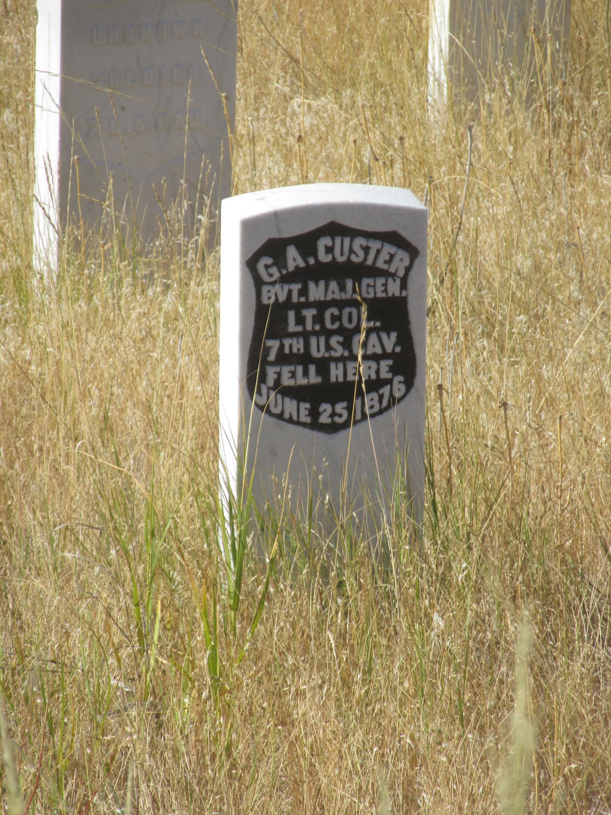
Headstones now rest where each of those killed in the battle had fallen. The white headstones are US Calvary casualties, the red headstones are native casualties. There are no headstones for the horses – apparently as it became clear to Custer’s men that they would not be leaving this place, many put a bullet in their horses’ heads knowing they would not be needing them further, and used their fallen bodies as their last defensive protection. A massive horse grave has been discovered by archeologists.
We visited a museum in Garryowen that is worth a visit. Out front of the museum is one of three tombs for the unknown soldier in the US, this one is a member of the ranks of Marcus Reno at the battle of Little Bighorn.

On June 25, 1926, surviving members of the native nations and the US Calvary met in Garryowen to “bury the hatchet” along with an unidentified soldier from the battle. General Edward Settle Godfrey of the 7th Cavalry and Chief White Bull, known as White Man Runs Him, met and shook hands at the historic celebration.

The museum had many really cool artifacts from the battle. One that amazed me were the actual native decorated leather gloves that General Custer had worn in battle that day. Kept hidden by a warrior from the battle in order to make sure they didn’t end up in the hands of the US Government, they were eventually donated to the non-profit organization that runs this museum. It’s chilling to think about the chain of ownership of these gloves, and what they have witnessed.
The nicknames for the native warriors fascinates me. They both mock the white man, yet decry the plight the natives faced under the thumb of Euro-Americans. One of the few native casualties at Little Bighorn was a Cheyenne battle chief known as Lame White Man. His name was amazingly prophetic as it related to the events of June 25, 1876.
While many of the native Americans of the time were photographed, especially by David F. Barry, one of the most famous photographers of the early West, Lame White Man was not. In this rare photo take sometime between 1871 and 1873, Wild Hog Cheyenne is on the left, and Lame White Man is on the right.
We had a fascinating visit, even if it did not make us proud to be Euro-Americans.
Talk to you soon!

Saturday, September 9, 2017

Billings

We drove around the Billings area and checked out the sites. While we didn’t find anything that knocked our socks off, we did enjoy our visit. We thought it a bit funny that the roadway maintenance folk in Billings couldn’t seem to make up their minds, however.

While we had driven by here on the I-90 many times, we had never managed to stop. Established by Slick in 2001, Pompey’s Pillar National Monument is only about a half hour East of Billings, and is well worth the visit.
Long before white Europeans invaded this land, the Crow considered this stone pillar on the banks of the Yellowstone River as sacred. As Merriweather Lewis and William Clark made their way back to St. Louis after their Corps of Discovery expedition, they spit up at Three Forks with Lewis heading along a Northern path, with Clark following the Yellowstone River.
When Clark got to the stone pillar that dominated the horizon, he pitched camp along the Yellowstone bluffs. He had become quite taken by Sacagawea’s son, Jean Baptiste Charbonneau, and referred to him as Pomp or Little Pompy. When it came time to place a name on the site in his journals, he named it after the son of Sacagawea.

One of the fascinating things about the site is that Clark carved his name into the pillar on July 25, 1806 – 211 years ago – and it is still there for you to see! While there is much documented about the track of the Corps of Discovery through the extensive journals of both men, this is the only location along the entire Lewis and Clark Trail that you can be certain you are standing in the footsteps of the explorers themselves – he had to have been in this spot to inscribe his name.

As we drove back into Billings we could barely see the downtown, and we could actually see the smoke drifting through town. It’s sad that most of the hiking trails and scenic roads we were on a month ago are now closed, and visitors evacuated. Even one historic lodge we had seen is now destroyed. Very sad.

I learned I maybe wasn’t as talented as I thought. I thought I had threaded the needle across the Beartooth Scenic Byway where vehicles over 40 feet (we’re a good 50 combined) are not recommended. But I heard the Woman scream as I brushed the right rear-view mirror against a 12-foot-tall whip marker for snow plows in the winter. I thought it was just the mirror. While there was no damage on the passenger side of Colectiva, I did manage to somehow shear off the running light and its plastic shield!
Talk to you soon!

Thursday, September 7, 2017

Fun drive!

Since we left a day early, we needed a parking spot for an additional night. Since we were unable to get an additional night in Billings – all full up for the Labor Day weekend – we stayed in Red Lodge Montana. We got lucky and found one of Peter Wolf Toth’s Whispering Giants outside the library – bonus!

Exiting Yellowstone toward Billings we drove the Beartooth Scenic Highway, which was on our to do list anyway. I guess I didn’t pay close enough attention when we reached the junction for US Highway 212. I thought there was a warning sign that indicated that vehicles over 40 feet were not recommended on 212 heading West. Given what Brenda was telling us, I think I mistook the warning as being 212 West, when I should have known it was 212 East.
This was likely the scariest driving I had ever done in Colectiva. The turns were so sharp that I could not maneuver many unless there was no oncoming traffic. Also, the pullouts to let traffic behind pass were few and far between. Luckily, traffic was extremely light, and all just small vehicles, so I was able to navigate without too much trouble, and let traffic pass in those rare moments when someone came up behind me. It was definitely white knuckle all the way.
We finally hit the summit at just under 11,000 feet – sheesh! But the views were astonishing, and we were able to pull over several times and just take in the panorama. If I had actually understood the sign, I would probably have not taken this road. In retrospect, I am really glad I didn’t understand it!
Red Lodge was all decked out for the Labor Day Weekend. It’s a cute little town with just about every building on Broadway being on the National Register of Historic Places. We strolled up and down reading all the historical information on the signage in front of nearly every building.
The old bank building in town was actually the site of a foiled robbery by the Sundance Kid and his Wild Bunch. On September 18, 1897, Sundance rode into town along with Kid Curry to carry out an unauthorized withdrawal from the Carbon County Bank. The actions of Sheriff John Dunn led to the capture of the gang, and they were returned to the Deadwood jail. Of course, they escaped again soon after.
Talk to you soon!

Tuesday, September 5, 2017

Yellowstone II

We made a bee line to Old Faithful. I remember the setting – surrounded by the Lodge and general store. You could literally watch the almost precise eruption from the balcony of the Lodge, which we of course did. As the old guy performed, I looked down to see the looks on Nick and Karen’s faces, but had to settle for the glow from the face of the Woman – nice!

I remembered taking the kids to see a bunch of the other geysers in the Park, but I can’t remember any of the others erupting. Some were so irregular that they might only erupt every few hours, and were completely unpredictable. Others could erupt anywhere between 5 days or 5 years! We were happy to see a number of the lesser known geysers erupt during our visits, a total bonus!
All the geothermal features are simply awesome. We particularly liked the mud flats where it seemed like the surface of the earth was completely alive. The array of colors is not to be imagined. The blues, the greens, the oranges and reds – just about every color of the spectrum is represented here, and it’s all natural.
Some of the hot springs were as impressive as the mud flats. Scientists say that acid resistant microorganisms are what give the hot springs their colors as well as the look that they are alive. You can see the dry, grey mounds that once were alive, but have now died off. Luckily, near each dead section is a massive thriving section that is alive and well.
The Woman wanted to head out on a wildlife hunt around dusk a few nights. We had yet to see a bear and really wanted to, so driving the Park at dusk was our best shot. We got skunked the first few attempts, but the night we waited until a bit later to venture out, we spotted a grizzly in Hayden Valley. He was strolling along the river, and even hopped in for a swim every now and then. While we couldn’t get very close, the zoom on my camera could.


While out visiting every corner of the Park we went through Firehole Canyon, which was spectacular. While driving through we saw a huge nest we thought was a Bald Eagle nest, but it turns out it was an Osprey nest, and was occupied. I guess I now know what I saw at the falls was not from Pirates of the Caribbean.
It’s hard to believe but the Woman tired of Yellowstone and wanted to bail a day early. So we will make our way to Billings where the pooch will get a well needed haircut.
Talk to you soon!

Sunday, September 3, 2017

Yellowstone

It’s been 23 years since we had Nick and Karen here just after school let out, our tent pitched between the snow piles, seeing our breath at night. This experience is much different. We haven’t seen the bison roaming around our campground as we did back then, but haven’t had a day yet where we didn’t encounter a parking lot on the main highway caused by these massive beasts, and of course, all the “Lookie Lous”!

Of course, the Woman couldn’t but help but becoming a bit of a “Lookie Lou” herself. I didn’t roll down her window this time, like with the giraffe!
Despite being the end of August, all the waterfalls are spewing copious amounts of water. We have no idea where all this water comes given we can’t see any snow cover within the park. But there must be snow cover melting somewhere as we’ve been to over half a dozen waterfalls, and all were raging. A couple were so powerful that they created spectacular rainbows in the midst of bright sunlight!
The Woman again discovered that the Continental Divide Trail runs nearby Old Faithful geyser. Not being satisfied unless she hikes portions of the CDT when she is near it, we set out to find where it crossed the main highway.
We managed to find a section and we hiked maybe a mile or so. The Woman was nervous about bears because of all the Ranger talks we had been to, and so she didn’t want to go in too far when it was only the two of us. She kept yelling at the top of her lungs “Yo bear! Stay away!”, so there was not much chance of a surprise encounter. We found the blazes here much different than we had seen anywhere – fluorescent orange tabs stapled to trees near the trail. Must be the local Ranger’s addition.
We biked from our campground to the only natural stone bridge identified in the Park. While not as spectacular as those in Arches National Park and Natural Bridges National Parks in Utah, it was still fun, and we were pretty much the only ones there.
We’ve had some good wildlife sightings. We spotted some moose on our way into the park, but there was no way to park Colectiva to get a closer look. These Elk showed up near dusk by the local waterhole, and were happy as long as nobody tried to get too close.
I have no idea what this bird is that we saw alongside the Yellowstone River near the lower falls. He looks like something that should perched on Captain Barbosa’s shoulder in Pirates of the Caribbean, Dead Men tell no Tales.
Talk to you soon!