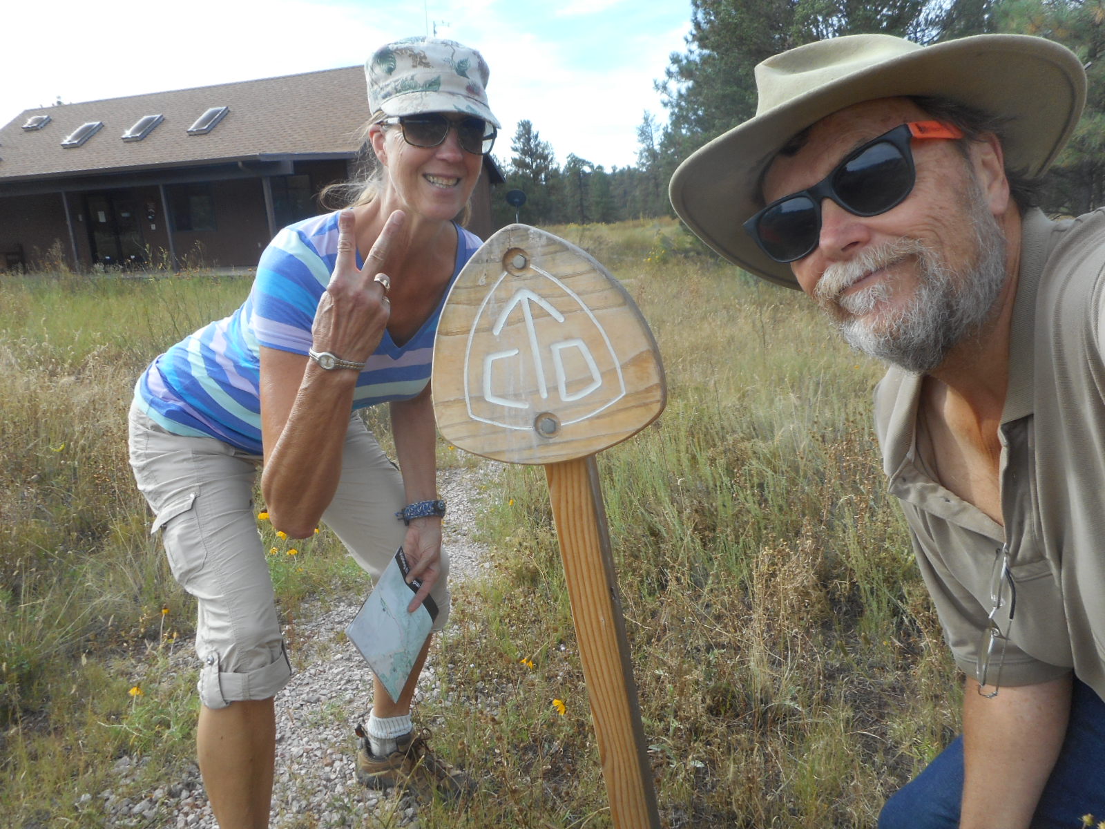
We never
expected to be in a tiny town nearly in the center of New Mexico, but near
Mountainair we found another US National Monument that we hadn’t visited. Since
its only 80 some odd miles southeast of Albuquerque where we were heading for
the Balloon Fiesta and with some time on our hands and with an RV park there
with good wireless internet, we were in!
 Salinas
Pueblo Missions National Monument recognizes the presence of both Spanish
Conquistadores and the Franciscan Church to the early development of what is
now New Mexico.
Salinas
Pueblo Missions National Monument recognizes the presence of both Spanish
Conquistadores and the Franciscan Church to the early development of what is
now New Mexico.
 The
record of the Spanish in what is now the southwestern US would not put our
record to shame at all. When the Spanish entered this land, they were in search
of the 7 lost cities of Cibola (hence now the naming of the forests in this
area as the Cibola National Forest). When they entered, chronicled as early as
1527, the only focus was the location of these 7 ancient cities, which were
rumored to be rich with gold. In their search for the Seven Golden Cities of
Cibola, the Spanish did not allow the local residents to get in the way – they
simply overpowered them.
The
record of the Spanish in what is now the southwestern US would not put our
record to shame at all. When the Spanish entered this land, they were in search
of the 7 lost cities of Cibola (hence now the naming of the forests in this
area as the Cibola National Forest). When they entered, chronicled as early as
1527, the only focus was the location of these 7 ancient cities, which were
rumored to be rich with gold. In their search for the Seven Golden Cities of
Cibola, the Spanish did not allow the local residents to get in the way – they
simply overpowered them.
 When the
Spanish ultimately decided that the Golden Cities didn’t exist, they saw no
other reason to occupy this baron land, and decided just to leave. The
Franciscan Church, however, saw thousands of potential converts, and decided
they would take on this challenge. In 1622 they built a massive mission at the
pueblo known as Abo, an impressive classic mission built by the labor of the
resident natives. The only focus the church had at the time was conversion –
they assessed the local agrarian natives to give up a significant portion of
their cultivated crops to the church, allegedly in support of their education.
Unfortunately, the burden on the crops in this borderline desert region
ultimately resulted in the failure of the entire culture.
When the
Spanish ultimately decided that the Golden Cities didn’t exist, they saw no
other reason to occupy this baron land, and decided just to leave. The
Franciscan Church, however, saw thousands of potential converts, and decided
they would take on this challenge. In 1622 they built a massive mission at the
pueblo known as Abo, an impressive classic mission built by the labor of the
resident natives. The only focus the church had at the time was conversion –
they assessed the local agrarian natives to give up a significant portion of
their cultivated crops to the church, allegedly in support of their education.
Unfortunately, the burden on the crops in this borderline desert region
ultimately resulted in the failure of the entire culture.
 In 1627,
the Franciscan’s then built the Quarai Mission, much larger and more elaborate
than even the massive structure at Abo. It was early in the time that the Franciscans
occupied the region and the taxing of its capacity had not yet been felt. In
visiting the ruins of the mission in Humana, it is very clear this was a much
more impressive development than even that at Abo, which was impressive
nonetheless. You could clearly see the aggression of the church in spreading
the “conversion” mentality.
In 1627,
the Franciscan’s then built the Quarai Mission, much larger and more elaborate
than even the massive structure at Abo. It was early in the time that the Franciscans
occupied the region and the taxing of its capacity had not yet been felt. In
visiting the ruins of the mission in Humana, it is very clear this was a much
more impressive development than even that at Abo, which was impressive
nonetheless. You could clearly see the aggression of the church in spreading
the “conversion” mentality.
 Finally,
in 1629, the mission at Gran Quivira was established, and it topped them all in
both scale and eloquence. While now the missions are only the foundations of
the once impressive structures, in the 1600’s they contained wide wooden
balconies, massive golden altars and statues, and all the trappings of a modern
cathedral. All the fantastic furnishings had been shipped by the Franciscan’s
up from Mexico City on the El Camino Real de Tierra Adentro, the historical
road of commerce in the days of Spanish occupation. Of course all these
beautiful and valuable pieces were removed when these missions were abandoned.
Finally,
in 1629, the mission at Gran Quivira was established, and it topped them all in
both scale and eloquence. While now the missions are only the foundations of
the once impressive structures, in the 1600’s they contained wide wooden
balconies, massive golden altars and statues, and all the trappings of a modern
cathedral. All the fantastic furnishings had been shipped by the Franciscan’s
up from Mexico City on the El Camino Real de Tierra Adentro, the historical
road of commerce in the days of Spanish occupation. Of course all these
beautiful and valuable pieces were removed when these missions were abandoned.
 One thing
that I found interesting was how the Missions and pueblos looked like whatever
native material existed in the area. Where the Abo and Quarai Missions were
constructed, the only material locally available to be quarried was red
sandstone. So, both these Missions are huge deep red monoliths that really
stick out against the mottled green of the surrounding foliage.
One thing
that I found interesting was how the Missions and pueblos looked like whatever
native material existed in the area. Where the Abo and Quarai Missions were
constructed, the only material locally available to be quarried was red
sandstone. So, both these Missions are huge deep red monoliths that really
stick out against the mottled green of the surrounding foliage.
 At Gran
Quivira, however, there was no red sandstone. The only material available to
quarry was white limestone. So, Gran Quivira is solely constructed of white
limestone, and because of this, it blends in far more with the surrounding
terrain of stone and plants. Despite the change in local materials, the
construction methods didn’t vary – rectangular stone cut from the earth,
stacked and mortared to create these monuments. Although not all that far from
each other, the available construction materials varied significantly.
At Gran
Quivira, however, there was no red sandstone. The only material available to
quarry was white limestone. So, Gran Quivira is solely constructed of white
limestone, and because of this, it blends in far more with the surrounding
terrain of stone and plants. Despite the change in local materials, the
construction methods didn’t vary – rectangular stone cut from the earth,
stacked and mortared to create these monuments. Although not all that far from
each other, the available construction materials varied significantly.
 Unfortunately,
despite their impressive size and construction quality, all these Missions and
surrounding Pueblos are simply ruins. The primary reason is the more hostile
conditions in the area. The Anasazi and other dwellers had learned how to grow
low water agriculture, and kept their numbers at a level where the land could
sustain their life. When the Franciscans came, they demanded that the locals
give their sole allegiance to God, and required tributes in the form of food
and labor be given to the church for protection of their souls (whether they
needed it or not). Also, the Spanish Conquistadores demanded that the locals
give their sole allegiance to the Queen, and also required tributes in the form
of food and labor to the Crown for their physical protection (again, whether
needed or not). There were frequent disputes between the Franciscan Priests and
the Spanish military as to which allegiance was primary, each side believing
its demands should take precedence. Anyway, all the demand for tribute
eventually caused the land not to be able to sustain the demands for food,
crops failed and drought conditions set in.
Unfortunately,
despite their impressive size and construction quality, all these Missions and
surrounding Pueblos are simply ruins. The primary reason is the more hostile
conditions in the area. The Anasazi and other dwellers had learned how to grow
low water agriculture, and kept their numbers at a level where the land could
sustain their life. When the Franciscans came, they demanded that the locals
give their sole allegiance to God, and required tributes in the form of food
and labor be given to the church for protection of their souls (whether they
needed it or not). Also, the Spanish Conquistadores demanded that the locals
give their sole allegiance to the Queen, and also required tributes in the form
of food and labor to the Crown for their physical protection (again, whether
needed or not). There were frequent disputes between the Franciscan Priests and
the Spanish military as to which allegiance was primary, each side believing
its demands should take precedence. Anyway, all the demand for tribute
eventually caused the land not to be able to sustain the demands for food,
crops failed and drought conditions set in.
 All this
led to the Pueblo Revolts of 1680. The locals rose up against both the Church
and the Crown. Of course the Spanish had no problems inflicting more damage due
to their superior weapons and armor and horses. But in the end, since there was
really no value to this area, the Spanish eventually fled to the Rio Grande
Valley where there was more reliable water for ongoing agriculture. The locals
also fled to the Rio Grande Valley for the exact same reasons. With no locals
and no Spanish protections, the Church also left, leaving these magnificent
structures to slowly waste away to what we can see today.
All this
led to the Pueblo Revolts of 1680. The locals rose up against both the Church
and the Crown. Of course the Spanish had no problems inflicting more damage due
to their superior weapons and armor and horses. But in the end, since there was
really no value to this area, the Spanish eventually fled to the Rio Grande
Valley where there was more reliable water for ongoing agriculture. The locals
also fled to the Rio Grande Valley for the exact same reasons. With no locals
and no Spanish protections, the Church also left, leaving these magnificent
structures to slowly waste away to what we can see today.
While it
is relatively remote, the Salinas Pueblo Missions National Monument is well
worth a visit. The understanding of the area a century or two before it became
part of the US is really interesting.
 In
Mountainair we discovered, as usual, other unsuspected rewards. Just south of
Mountainair lies the Shaffer Hotel National Historic Site. The Shaffer Hotel
was built in 1923 by Clem “Pop” Shaffer when he moved from his home in Indiana
to Mountainair New Mexico. Pop Shaffer was a blacksmith by trade, but fancied
himself an artist, and move to NM as a way to follow his art. He reveled in
creating wood and metal animal sculptures that were seen as masterpieces in
their time.
In
Mountainair we discovered, as usual, other unsuspected rewards. Just south of
Mountainair lies the Shaffer Hotel National Historic Site. The Shaffer Hotel
was built in 1923 by Clem “Pop” Shaffer when he moved from his home in Indiana
to Mountainair New Mexico. Pop Shaffer was a blacksmith by trade, but fancied
himself an artist, and move to NM as a way to follow his art. He reveled in
creating wood and metal animal sculptures that were seen as masterpieces in
their time.
 Unfortunately,
the hotel, while in good repair, has fallen on hard times. Mountainair is not a
tourist draw, but also has little competition for a well-run hotel. The main
problem seems to be the ghosts. The Shaffer Hotel is well known to be haunted.
While the hotel changes hands frequently, once opened by the new owners, it
does not take long for it to fail financially.
Unfortunately,
the hotel, while in good repair, has fallen on hard times. Mountainair is not a
tourist draw, but also has little competition for a well-run hotel. The main
problem seems to be the ghosts. The Shaffer Hotel is well known to be haunted.
While the hotel changes hands frequently, once opened by the new owners, it
does not take long for it to fail financially.
 We once
stayed in a B&B in Gettysburg that was alleged to be haunted. While we were
probably on edge all night and really didn’t get much sleep, we were fascinated
by the history of the place, and actually hoped we might encounter some soul
who found it hard to get rest in the place. While I know that had a lot to do
with our not sleeping much, it was still fun. Maybe the folk who visit
Mountainair are not in search of that kind of fun.
We once
stayed in a B&B in Gettysburg that was alleged to be haunted. While we were
probably on edge all night and really didn’t get much sleep, we were fascinated
by the history of the place, and actually hoped we might encounter some soul
who found it hard to get rest in the place. While I know that had a lot to do
with our not sleeping much, it was still fun. Maybe the folk who visit
Mountainair are not in search of that kind of fun.
 When he
built the Shaffer Hotel, Pop Shaffer live in Rancho Bonito, just south of town.
Also a National Historic Site, Rancho Bonito is where Pop chose to display much
of his artwork that he had moved to NM to expand upon. Built in 1937, the Rancho
Bonito grounds still hold many of his original creations. Because of his skill
as a Blacksmith, most of Pop Shaffer’s creations were mythical creatures made
of natural wood, metal and stone. (Don’t worry, those symbols on the building
are not Nazi Swastikas, they are actually Native American symbols denoting
healing rituals)
When he
built the Shaffer Hotel, Pop Shaffer live in Rancho Bonito, just south of town.
Also a National Historic Site, Rancho Bonito is where Pop chose to display much
of his artwork that he had moved to NM to expand upon. Built in 1937, the Rancho
Bonito grounds still hold many of his original creations. Because of his skill
as a Blacksmith, most of Pop Shaffer’s creations were mythical creatures made
of natural wood, metal and stone. (Don’t worry, those symbols on the building
are not Nazi Swastikas, they are actually Native American symbols denoting
healing rituals)
 Also near
Mountainair is Manzano Mountain State Park. The Park has some really nice
trails on the sides of Manzano Mountain in the Cibola National Forest. For some
reason doing 8 miles in one trek of 5 hours does the Woman in. However, we
ended up hiking more than 8 miles in this beautiful wilderness area as well as
the Missions, and probably clocked more than 5 hours in doing it. But there
were nearly no complaints from the Woman at all today – interesting!
Also near
Mountainair is Manzano Mountain State Park. The Park has some really nice
trails on the sides of Manzano Mountain in the Cibola National Forest. For some
reason doing 8 miles in one trek of 5 hours does the Woman in. However, we
ended up hiking more than 8 miles in this beautiful wilderness area as well as
the Missions, and probably clocked more than 5 hours in doing it. But there
were nearly no complaints from the Woman at all today – interesting!
Talk to
you soon!
 So on our
next hike, I said aloud “I would wish to see some four legged wildlife. Well,
my request was granted. However, instead of a mountain lion or the like, this
is what we got.
So on our
next hike, I said aloud “I would wish to see some four legged wildlife. Well,
my request was granted. However, instead of a mountain lion or the like, this
is what we got. So on the
next hike, I thought I needed to be more specific. So as we headed out I said
aloud “I would wish to see a four legged mammal. Again, my wish was granted,
but again nothing big. This is what we got.
So on the
next hike, I thought I needed to be more specific. So as we headed out I said
aloud “I would wish to see a four legged mammal. Again, my wish was granted,
but again nothing big. This is what we got. So I tried
again. On our next hike I said aloud “I would wish to see a four legged mammal
that has legs longer than a foot or so.” Again, my wish was fully granted, but
I had again been too cryptic – we tend to see lots of deer, even though this
guy was beautiful.
So I tried
again. On our next hike I said aloud “I would wish to see a four legged mammal
that has legs longer than a foot or so.” Again, my wish was fully granted, but
I had again been too cryptic – we tend to see lots of deer, even though this
guy was beautiful. So I
finally said to heck with it – none of this general inference. On our next hike
I said aloud “I want to see bear or cougar!” Well, wish granted. Although this
guy was moving pretty fast one he heard us and between the zoom and his speed,
it’s a little blurry in the photo. But now I know to be more specific!
So I
finally said to heck with it – none of this general inference. On our next hike
I said aloud “I want to see bear or cougar!” Well, wish granted. Although this
guy was moving pretty fast one he heard us and between the zoom and his speed,
it’s a little blurry in the photo. But now I know to be more specific! Hopefully
we never get a chance to encounter this particular kind of wildlife out on our
hikes. While they claim to be big in Alaska, even there they are not this big!
Hopefully
we never get a chance to encounter this particular kind of wildlife out on our
hikes. While they claim to be big in Alaska, even there they are not this big!