Tuesday, June 27, 2017

Gotta love it!

It seems like all kinds of folks consider themselves comedians. But many have no real outlet for what they consider their talent. Along our many travels and wanderings, we have uncovered such comedians attempting to scratch their itch using signs.

I have no doubt that every city in every town – not just in America but all over the world – has at least one of these roadways, if not officially, then at least by reputation. I can only imagine how many of these are in Washington DC.
Probably the topic you see addressed over and over and over in RV Parks is folk who refuse to clean up after their pets. Most of the time it is just
nagging or complaining or pleading. Every now and then something funny pops up.
Talk to you soon!

Sunday, June 25, 2017

Sad change in plans

The Woman’s dad Jim has had a tough bout medically lately. He may be confusing the meds he takes, he has been able to eat little for quite a while, and has become unbelievably weak. As a result, he ambulanced over to Regions Hospital for help. They discovered a very aggressive for of urinary tract infection, so aggressive that they quarantined him for fear of it getting out in the hospital.

Weak, not eating, and not up for what they suggest to deal with the aggressive infection, he has decided he wants to be checked into a hospice. Emergency flights out of Mount Rainier National Park are not something doable. Our next option was to set out the 300 to Spokane so the Woman could catch a flight to St. Paul to see her dad. That leaves me with a marathon 1,400-mile jaunt to St. Paul with Colectiva and the pooch.
After dropping the Woman at the airport, I decided to kill a couple of hours in downtown Spokane. Neither the Woman or I had ever been here – now it’s just the Woman who hasn’t. It didn’t strike me as either cosmopolitan or quaint like some of the smaller burgs we’ve visited in the state. But it is right on the Spokane River, and Spokane Falls are pretty much right in the middle of downtown.
While not a lot to see, I did walk around enough to find a restaurant on the bluffs overlooking Spokane Falls. I grabbed a local Porter, some seared Copper River Salmon in soy sauce with ever so thin ginger slices, and lived the dream.
Tomorrow early I begin the marathon, with hopes that Jim will still be around when I get there. So, for now the planned itinerary has been scrubbed. We will see in a bit whether any of it can be salvaged, not that salvaging it is important at this time.
Talk to you soon!

Friday, June 23, 2017

Milestone

Well, we hit another milestone while in La Wis Wis Campground. We managed to find our 1,500th geocache – 1,500 that is since we took up the hobby.

The cache owner indicated that they had been camping at La Wis Wis for 35 years. Their favorite location in the campground was the Blue Hole, a deep, swirling basin in the tumultuous __ river that runs through the grounds. Apparently in the summer time it’s a favorite swimming hole. But right now, it’s both too cold and too swift for swimming.
We were able to walk to the cache location right from Colectiva. Kona came along as witness for the milestone. Bonus!
Talk to you soon!

Wednesday, June 21, 2017

I fudged up!

We made it to Mount Rainier National Park and found the La Wis Wis campground managed by the Forest Service.

When I made the reservation on www.recreation.gov, the site told me they could accommodate up to a 42-foot motorhome on their H loop. On arrival, we clearly questioned their judgment! The first thing we encounterred was a long narrow bridge into the loop – literally only a few inches of clearance on either side of Colectiva. To add to the excitement, there is a 90 degree turn at the entrance to the bridge.
I really thought I nailed it. But I heard a little noise as we crossed that made me assume I misjudged a bit. Upon parking and setting up Colectiva I learned that I had missed center by maybe a 1/16th of an inch. While not overly intense, it still left a mark.
Mount Rainier National Park is magnificent. We stopped here on our way to Alaska, but that was in either late April or early May, and nothing In the Park was open. We only were able to drive on some of the low roads around the base. While snow still covers all the higher regions, 2 of the visitor centers are open and all the main roads.
There is still so much snow in the upper regions of the mountain that most of the visitors up here are doing one of two things. They are either snowshoeing (100% of the trails are under snow) or they are cross country skiing!
All in all, both the Park and the mountain are glorious. The waterfalls are spectacular as the massive snow cover is still actively melting. Despite the snow the crowds are still dense. Nearly every parking area we have stopped at are full. I am glad we had a chance to come back and see more.
Talk to you soon!

Monday, June 19, 2017

We found it!

On the way to Yakima we decided to check out Hanford Reach National Monument. And we think we finally found it! The National Monument with the least services available to visitors. There isn’t even a traditional sign anywhere that gives you a clue when you are in the Monument. You just have to trust Google, and read cryptic references to the Monument on informational signage about history in the area.

The Monument is the dead zone that was created by leaked radioactivity from the Hanford Nuclear Reservation, a reactor that developed material for the atomic weapons programs running in 1943. Slick designated the Monument in 2000. Because decontamination efforts remain ongoing, most of the land mass in the Monument is not open to the public. We did enjoy learning about the area’s involvement in the Manhattan Project, however.
We thought we got snowed out way too much in Oregon. We learned we had it easy there. We headed for Chinook Pass outside Yakima in order to hike a little of the Pacific Crest Trail, which crosses Washington State Highway 410 at the Pass. When we made the turn off US Highway 12 there was a lighted sign saying “410 now open.” Ominous! Well we got there, and not only was there snow completely covering the PCT but there were still snowplow drifts that were very clearly 30 or 40 feet high! When will it end?
We are heading to a Forest Service campground at the base of Mount Rainer, and then another in Cascades National Park for the next couple weeks, so we may have limited or no access to internet. So if I don’t get anything posted in-between, I will reboot the blog on the other end.
Talk to you soon!

Saturday, June 17, 2017

More Columbia River

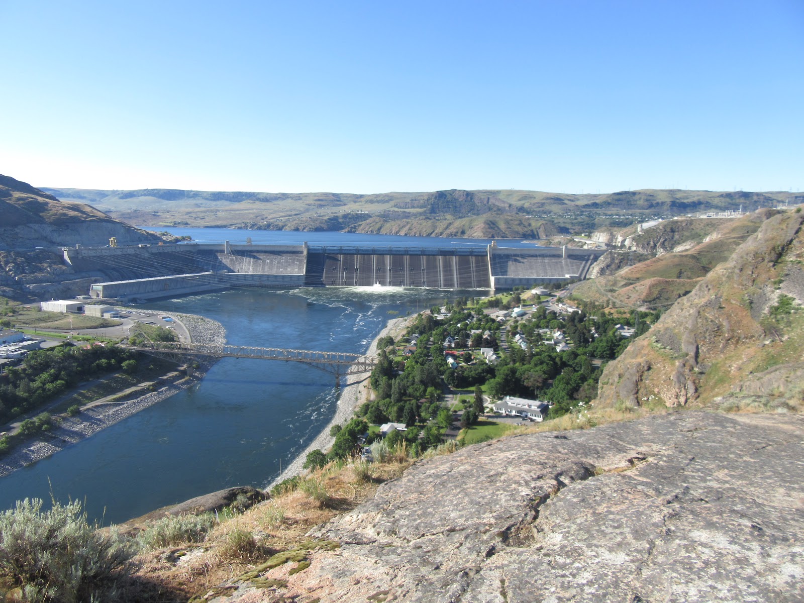
We visited and toured the Grand Coulee Dam, a true multipurpose structure. The dam controls what used to be the annual flooding of cities along the gorge, has the second largest hydroelectric generating capability in the world, and provides irrigation for over a million acres of fertile land now producing massive agricultural crops that used to be barren. When completed in 1941, the Grand Coulee Dam was both the largest construction project and the largest concrete structure in the world. In 2012, it was surpassed by the Three Gorges Dam on the Yangtze River in China. Interestingly, we have also been to that dam as well.

We learned that despite its achievement, the dam was not built without breaking some eggs – lots of eggs apparently. 14 towns and thousands of settler’s homesteads were submerged when the basin behind the dam filled. Sadly, despite the assurances that the federal government would assist everyone in their relocation, apparently little or none of that assistance actually came. In addition, at least a dozen sacred native burial sites are now under thousands of feet of water. Finally, the natives north of the dam were totally dependent on the abundant salmon both for food and as their primary trading medium. Sadly, despite trying to install fish ladders, it turns out the dam is too high, no salmon can spawn above it anymore, and the population of salmon in the Columbia River plummeted precipitously.
Every night the Bureau of Reclamation along with other government departments puts on a laser light show that covers the entire face of the dam. The show was technically well done and was very interesting to attend.
We wanted to visit Kettle Falls, one of the more famous of the submerged towns. However, it was some 65 miles upriver, and after doing some research, learned that there is really no way to visit the former town. There are some remnants that residents had relocated as the rising waters approached. However we decided that there might not have been enough compelling to warrant the 2 hour one way travel investment.
Talk to you soon!

Thursday, June 15, 2017

Dry falls


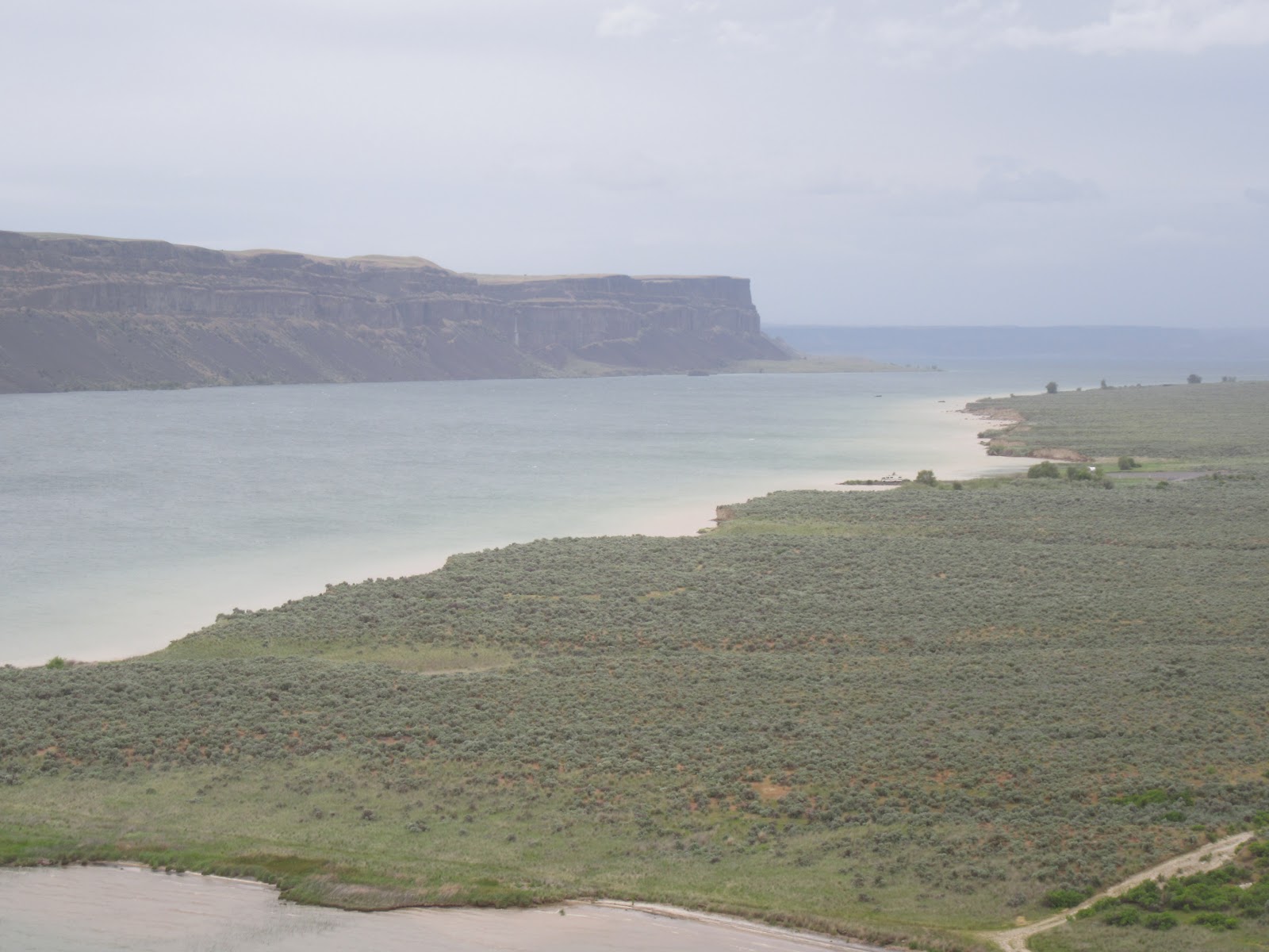
We visited Dry Falls in Washington. Apparently at the end of the Ice Age, glaciers blocked the otherwise normal flows of many rivers in the northwest causing an immense lake of stranded water. When the water broke, it resulted in a monumental wash of the NW US with raging waters that eroded cavernous terrain and produced geologic features that were not recognized as being created by the existence of water until current years.


dDry Falls is one of those features not recognized until the 20th century. Toward the end of the ice age, it saw 10 times the water flow that now graces Niagara Falls. 3 times as wide as Niagara and over 400 feet in height, the flow here, believed to have been upwards of 300 feet deep, would have dwarfed what is the greatest falls in North America.

This intense glacial flood created ripples across the north-western US that, from the ground level, just look like rolling hills. But once we had the perspective of seeing the NW US from space, it was clear that these features were ripples just like those created on the floors of oceans and the great lakes.
While no water flows over the edge today, the ripples and carved canyons (called “coulees” by scientists) remain as evidence. We enjoyed the visit and the history lesson.
Talk to you soon!