Sunday, October 22, 2017

Winnipeg Manitoba

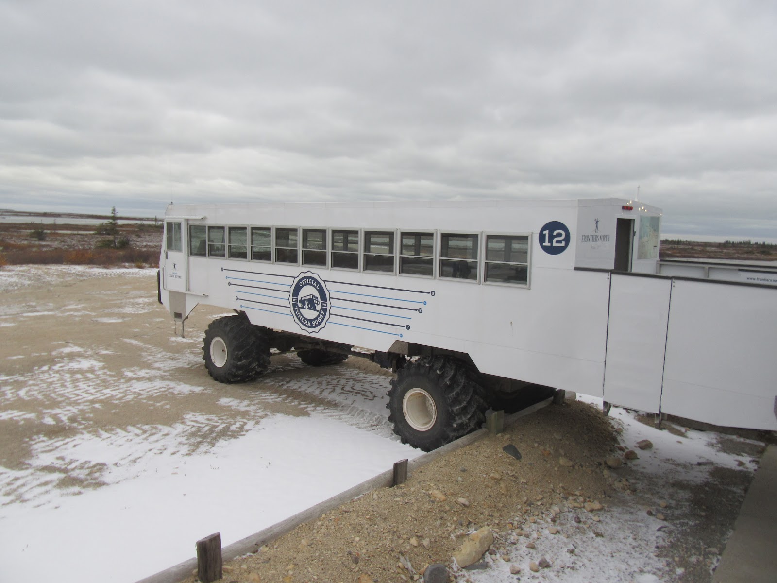
We’ve been to Winnipeg before but didn’t take in the sights. So, now was our chance. Winnipeg sits on the vast Manitoba plains, as flat as can be. So renowned architect Etienne Gaboury took it on himself to build some mountains in Winnipeg. Precious Blood Roman Catholic Church is one of the many mountains French born Gaboury was responsible for. He built another “mountain” in his design of the main downtown bridge across the Red River.

Another mountain Gaboury was the architect of is the Royal Canadian Mint in Winnipeg. We got to tour the mint and learn about what has turned into big business. Built in Winnipeg in order to minimize shipping costs (Winnipeg is just about in the dead center of Canada), the mint actually makes coins for over 170 countries throughout the world. During a brief time when the US mint was having a material supply problem the Winnipeg mint even made some coin blanks for the US.
We visited the remains of Upper Fort Gary, another of the string of early Hudson Bay Company trading posts. All that remains is the East gate of the fort, but considering that it was built in the early 1800’s, it’s still pretty impressive. It lies in the shadow of the historic Hotel Fort Gary, where the wealthy and famous were put up after arriving in Winnipeg at Union Station, across the street.
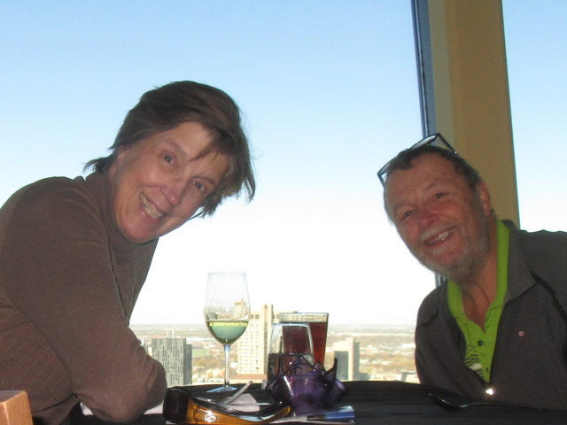
We grabbed lunch getting an hour long panoramic view of all of Winnipeg. The saucer shaped structure on the top of the high rise in the last picture is the Prairie 360 restaurant. It has a revolving seating area that lets you dine and get a private tour of the town. Since the only mountains anywhere near are the ones designed by Gaboury, you get an unobstructed, spectacular view.
We toured the Manitoba Legislative Building, completed in 1920. We learned that it was designed by Frank Worthington Simon, a notable Free Mason of the times. As we toured the impressive stone building, our guide pointed out all the mysterious Free Mason symbolism that was built into the structure. There were hundreds of such symbols that otherwise would just look like interesting decorations. 
On the dome of the Legislative Building is one of the objects most recognized by Winnipeggers. Known as the Golden Boy, this statue of Mercury shows up in most tourism related brochures, and on post cards anywhere you look. The sun gave us a nice show of it this day.
We visited the gravesite of Louis Riel, in the shadow of the ruins of the St. Boniface Cathedral. Louis Riel was a Metis who campaigned tirelessly for the preservation of lands, rights and the culture of the Metis. He is credited for creating the movement that resulted in the granting of Manitoba the status of a province of Canada in 1870.
Sadly, his activities that resulted in Manitoba being admitted as a province ended up not serving him well. His activities to preserve the lands, culture and rights of the Metis got him arrested and tried for treason against the Nation of Canada. He was found guilty and hung on May 20, 1885. This statue of Riel used to sit outside the Legislative Building, but locals found it to risqué and so it was moved to Assiniboine Park. Interestingly, it was sculpted by Etienne Gaboury.

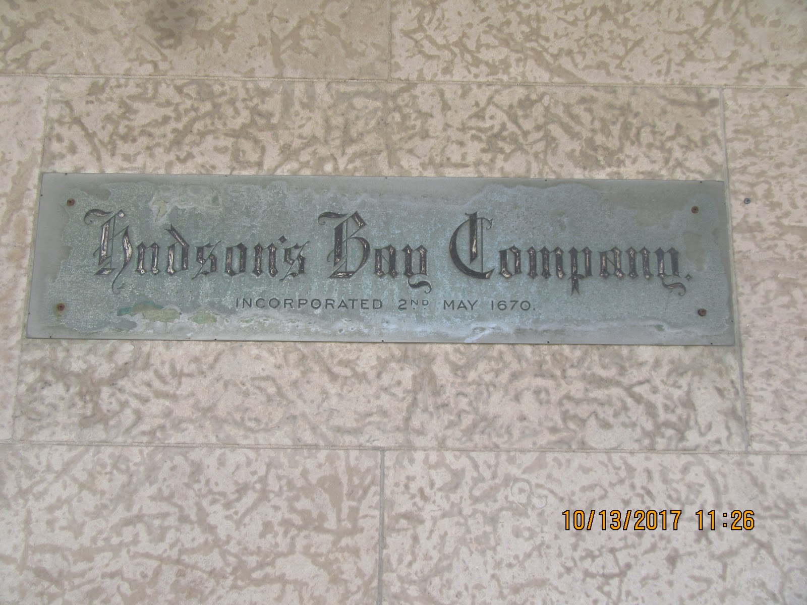
Not only did we visit all the historical Hudson Bay Company trading forts, we decided to peek into the original Hudson Bay Company department store in downtown Winnipeg. The store used to have 8 floors cram packed with merchandise for sale. Now, with the advent of online competition, 6 of the floors are empty and only the first two are open to shoppers. It’s still cool though to think that this is the first company ever to be incorporated, by British Royal Charter, on May 2, 1670!
Talk to you soon!

Friday, October 20, 2017

Churchill III

From everyone we talked to, if you live in Churchill, you don’t just have one job – you have many. Apparently, you can’t just find one occupation that will meet all your living needs. Many are tour guides, but also work as Park Rangers for the Provincial Government or Parks Canada. Most seem to do gun repair or refurbishment, as the needs for guns here for bear protection is a focus. While hard to see here, Kevin Burke has his name painted on this personal tundra buggy #12. He is the only Churchill resident that drives for the only tow companies allowed to venture on the tundra.

Given the local dependence on various and different forms of transportation, apparently sled dog teams get priority in Churchill when it comes to parking. There was not enough of the white stuff on the ground yet for us to be able to confirm this.
In Churchill, it used to be that Polar Bears were on a three-strike system – first time in town, they were tagged with a green tag. Second time, they were tagged with red. Third time, they were shot. Now that they have recognized the importance of the Bear to their economy, they have instituted a Polar Bear jail. If Bears come into town, they are trapped and incarcerated in these units.
The Bears are taken to a jail facility where they are held for several days. While held, they get no food or water, so not to encourage them to revisit. After being incarcerated for several days, they are netted and flown considerable miles from town in hopes that they don’t return. We visited the Polar Bear jail, but folks aren’t allowed inside to see the convicts.
Believe it or not, this is actually a real street in Manitoba. It’s great to have confirmation of Canadians’ sense of humor.
Many Manitoba towns we visited had the kinds of murals we saw on the outside of the Polar Bear jail. Churchill had its share of murals, with more than a dozen on sides of buildings throughout town. The murals add a mystique to the already interesting settings that are the backdrops of rural and Northern Manitoba.


I am pretty sure that this sign could be put on Colectiva as well. Kona the pooch suffers from the same lack of control.
Talk to you soon!

Wednesday, October 18, 2017

Churchill II

With our two days out on the tundra, I figured out how this works. About 25 miles South of Churchill is Wapusk National Park. The Park is the 4,500 acres representing the world’s largest known Polar Bear maternity dens. Churchill happens to be where Hudson Bay fist starts to freeze in October/November. So, after cubs are born in the Wapusk dens, the Polar Bears flock to Churchill so they can move out onto the ice floes of Hudson Bay where they hunt seal to survive.

For some reason I had the impression of a migration, crossing expanses of land. But it is rather a point of entry to the ice of the Hudson Bay that brings them here. While prepared to be skunked – bear sightings were not guaranteed in any of the tour literature – we were blessed with seeing 3 real live Polar Bears in our two days out in the tundra. Two of the bears we saw at a considerable distance, but enjoyed them none the less. This lone bear decided to perform for us close up, which was the highlight of our visit.
When we headed out in our tundra buggies, we were told we were looking for the big four. Of course, Polar Bears were the focus. But we were to keep an eye out for Arctic Fox, Arctic Hare and Ptarmigan. We had seen Ptarmigan in Alaska, but were excited to see them again in the Churchill tundra. It turned out we saw several dozens of them, always pecking and eating the local vegetation.
Our guide, Kevin Burke, told us that Arctic Hare were elusive, and that he often didn’t spot any on his trips out in the tundra buggy. However, he spotted one in the brush, and as he had said, it was very shy and elusive.

However, after we pulled up and parked the buggy for a bit, he decided to show off a bit for us. He circled the tundra buggy a few times, nibbling at the vegetation at a leisurely pace, and then posed for some photos. Nice!
The same thing happened with the Arctic Fox. We actually saw two of them. The first we saw was very white, which Kevin said was their coloration once the snows hit as it gave them the camouflage needed for survival. This guy was hunting rodents of some sort, and we enjoyed his jumping and pouncing on the unsuspecting prey.
Just like the Arctic Hare, this fox decided to put on a show for us. He came close, posed, and generally followed our buggy for quite a while. This guy was still a bit greyer, and hadn’t quite yet reached the pure white he would before the major snow flies. But he was stunning, and his acting ability was undisputable.
The climactic extremes here effect everything. All the pines in the area are referred to as one sided trees. That is because the winds prevent the trees from developing branches on the windward side. Not only are the trees one sided, but their development is even affected. This pine, while looking like a sapling, is well over 450 years old. Sheesh!
All in all, we had a spectacular display of what Churchill had to offer. And the hospitality was astounding. However, even though I got a chance to drive the tundra buggy for real, I don’t think I could ever muster up the chutzpah to attempt to live in a climate like this again.
Talk to you soon

Monday, October 16, 2017

Churchill Manitoba

Change in plans. In late June, the heavy spring rains washed out about 800 feet of track owned by Omni Trax, so we had to fly instead. I don’t know who paid for the extra cost of our flights – I assume that Fantasy RV Tours absorbed it. So, to revel in the moment, we decided to have a donut (at least the Woman did) in the terminal in Thompson. Catchy name!

In 1997, the Canadian National Railway agreed to sell the tracks from The Pas to Churchill in Northern Manitoba to a US based company called Omnitrax. The sale agreement contained legal assurances that Omnitrax would maintain the service necessary to serve this community. Omnitrax now states it cannot afford to replace the flooded-out track, and that their agreement did not anticipate this unexpected added financial cost.
The Canadian government has demanded that Omnitrax replace the tracks in 30 days and restore the tracks and resume the only effective supply line to Churchill, but nobody expects anything to move on the situation before spring. Locals have told us that tourism has plummeted, down by as much as 70% with the lack of access to the area. In addition, any construction in the area has ceased as the materials needed that were ordered last fall are still at the rail stations in Thompson or The Pas.
So Omnitrax exerts no effort to repair the track. When the track washed out, they had a passenger train sitting in the station in Churchill. They sent a ship to collect that engine and cars – trains sitting make no money. But the only docks were owned by the Canadian government, who have denied them the access to move their engine and cars onto a ship. So, while this saga plays out, we walked over to see the hostage train engine and cars sitting dormant in the rail station in Churchill.
This actually afforded us a bit of a small bonus. We wanted to visit some sled dogs in Churchill at the kennel of David Daley, the founder of the Hudson Bay Quest, the most grueling sub-arctic sled dog race that currently exists. Normally a minimum of guests is required to get a visit.  Bad for them but good for us, they decided not to enforce the minimum since their tourism rates have been so low, and the cost of maintaining the dogs has increased dramatically with the train out.
We had a great ride, and got a little bit of a puppy fix, since we are currently separated from Kona. We enjoyed our visit thoroughly, learning a great deal about the Metis culture – Dave is Metis. Metis literally means half-breed – born of the union of Cree natives with the French fur traders. They developed their own language, customs and culture, and survived the onslaught of the Canadian westward expansion, not at all unlike the native nations we learned more about in South and North Dakota.
Churchill has only about 850 full time residents. But it has plenty of interesting things to entertain the visitor. We would our way to the Prince of Wales Fort that was an early fur trading fort established by the Hudson Bay Company, the first ever corporation acknowledged by the King of England. Of course, because of the possibility of Polar Bears, our bus driver was armed with a rifle and he carried it with him as we walked around the fort, which is a Canadian National Historic Site.
Talk to you soon!

Saturday, October 14, 2017

On the road to Churchill Manitoba

After leaving the International Peace Garden we needed to make our way North – way North that is! Our main destination is Thompson Manitoba, pretty much the furthest you can drive North in the Province. The only ways into Churchill are by sea, air or rail, you can’t drive. We are to grab a train when we arrive, leaving Colectiva and the pooch in Thompson. On our way we passed through the Turtle Mountains, and spotted this massive sculpture made from over 5,000 automotive wheel rims.

We stopped in Dauphin for a night. We visited St. Georges Ukrainian Orthodox Church, built in the 1930’s by Father Philip Ruh. Ruh went on to design and build several Ukrainian churches in Canada, known for his classical designs and intensive internal use of religious icons. We got to tour the church with one of the local parishioners who also sits on the Board that preserves the iconic structure. 
She told us how it had fallen into disrepair and was slated for demolition, as did most of Ruh’s masterpieces. However, the Ukrainian community pulled together, raised funds, and got the church put on the Canada’s Historic Register. After the tour and an introduction to the deep Ukrainian heritage in Canada, we were treated to a traditional Ukrainian dinner in the hall of the new church across the street. A group of half a dozen parishioners fed us and serenaded us with some traditional Ukrainian songs. It was grand!
We also visited Fort Dauphin, a strategic trading post for the Voyageurs during the time of the fur traders. We were regaled by locals dressed in period clothing and told about both the operation of the fort, as well as life in Northern Manitoba. I got to learn first-hand how the Voyageurs were able to carry 70 pounds of gear and still portage their canoe. One docent who lived on a farm not far outside Dauphin told us that when she was young, she washed clothes in a bucket. They didn’t get electricity and phones until the 1970’s, and didn’t have high speed internet until the last decade. It sounds like things I took for granted all my life have only come relatively recently to Northern Manitoba. Sheesh!
On the final leg from The Pas to Thompson we did lunch at the Pisew Regional Park. The hike to the upper falls would have made us late in arrival in Thompson, so we only hiked to the lower falls. However, I can’t imagine that the upper falls could have been any more impressive than the lower falls. Both the Woman and the pooch were quite impressed.
Thompson being essentially the furthest North you can easily drive is one huge float plane base, helping locals and tourists to penetrate a bit further. Artist decorated wolf statues are all over town and each is impressive. I wish we could have spotted an unpainted one stalking around, but we weren’t blessed with that luxury.
Talk to you soon!

Tuesday, October 3, 2017

No man's land

When we read the directions on how to get to our campsite we assumed there was a mistake. But there wasn’t. On the US/Canadian border about 15 due North of Dunseith North Dakota is the International Peace Gardens, a cooperative joint project of both the US and Canadian governments. Our instructions said that after you pass through the US border crossing (legally, you have left the US), but before you enter the Canadian border crossing (legally, you haven’t entered Canada), turn left and enter the Gardens. We were surprised to find out that in the maybe 100 yards that separates the US and Canadian border stations, there is in fact a park straddling the border. It’s the only one of its kind anywhere.

The Park is a cooperative effort of both governments, established in 1931 to celebrate over 100 years of peace and cooperation between the US and Canada. About ½ the Park lies North of the border, and the other ½ lies South. When we were Medora, the museum at Chateau de Mores had a wing dedicated to the Civilian Conservation Core and all the work it did in Theodore Roosevelt National Park, as well as the restoration of the Chateau. We learned there that the 2676 unit of the CCC that worked there also worked at the International Peace Garden, building much of the infrastructure on the US side that is still in use. This historic lodge on the US side of the Park is one such example.
It’s weird not being officially anywhere. In 1931, they were considering putting the Park at Niagara Falls. However, this border crossing won out for two reasons – 1. it’s about the center of the border between the two nations, and 2. this highway runs as far North as paved roads go in Canada, and in the US, runs to the Mexican border. When you leave the Park, if you turn right, you have to show a passport to legally enter the US. If you turn left, you have to show a passport in order to legally enter Canada. While you are in the Park, you certainly feel like you are somewhere, until Onstar announces a warning that you are approaching a border crossing – I didn’t know she even did that! But she does it a lot as we freely drive around this approximate 2,400-acre prairie wilderness park.
There are many interesting exhibits in the Park, too many to mention. We were surprised to find that there is actually a 9/11 Memorial here located on the main garden promenade that straddles the 49th parallel the entire width of the Park. The 9/11 Memorial discusses the joint cooperative efforts of the US and Canadian governments in accepting diverted air traffic and passengers on that ill-fated day, as well as joint efforts to counter terrorism since. The Memorial is complete with twisted and charred beams from the Twin Towers.
We visited the Peace Chapel. The Chapel straddles the 49th parallel, exactly half of it lies in Canada and exactly half lies in the US. When they began constructing the building in 1969, they soon learned it was actually illegal to build a building on top of an international border. They had to stop construction and apply for a special treaty to be signed allowing the construction of this chapel. According to the rangers at the Park, this is the only building in the world that was deliberately allowed to be built straddling an international border. As a tribute to the theme of the Gardens, the Chapel contains hundreds of quotes engraved in marble on the walls. The quotes come from famous peace leaders such as Buddha, Gandhi, Abraham Lincoln and a host of others. It’s worth a visit if you ever get to this very interesting Park.
In Dunseith we found this W’eel Turtle, allegedly the largest turtle sculpture in the world that is made entirely from automobile wheels. I guess everyone needs to be known for something! Tomorrow we begin our Caravan to Northern Manitoba to hopefully see some Polar Bears. We are not sure what kind of accommodations we will have, and whether we will have any internet connections, so if we are offline for a bit, we will return in a couple of weeks, hopefully with a few good pictures.
Talk to you soon!

Sunday, October 1, 2017

Doing silly things in North Dakota

Since we already had been to the geographic center of the US which was in South Dakota, we decided to check out the geographic center of North America, which is in North Dakota. Well, it turned out to be a bit more challenging than we first suspected. According to the USGS it lies about at the intersection of 1st Street West and Lakota Avenue North in Center North Dakota. Sadly, there is no marking whatsoever in the town of where the acknowledged geographic center is. Interestingly, the name Center was given to the town in 1902, not because the USGS had proclaimed it the geographic center of North America, but because it was roughly in the dead center of the state of North Dakota.

While exploring town, we discovered this interesting monument dedicated to Hazel Miner. The monument is just that, a monument, although it has the appearance of a tombstone, which it is not. Hazel Miner was a 15-year-old from Center who got lost in a blizzard on March 15, 1920, along with her younger brother and sister, on her way home from school. As night fell she lay on top of them, saving their lives while sacrificing her own. The monument is a dedication to her bravery.
So, there are two other alleged geographic centers of North America, and we decided we needed to check them out. One was in Hanson’s Bar in Robinson North Dakota. Bill Bender was the mayor of Robinson in the 1960’s, when the town of Rugby North Dakota about 85 miles North and near the Canadian border had made claim to that distinction. Bender decided that with the melting of the polar ice caps the geographic center was logically moving South, so he filed for and was awarded a trademark as the geographic center of North America.
As is often true in a town with a population of 37, Bender also owned the only bar in town, Hanson’s Bar. Interestingly enough, when they determined where the actual geographic center of North America really was, it was pretty much in the center of Bender’s (or should I say Hanson’s) Bar. Man, how lucky can a guy get! Of course, Hanson was clever enough to send in a copyright application for the name “Geographic center of North America” and was granted it. Lucky and smart!
The other alleged, but inaccurate, geographic center of North America is in Rugby North Dakota. The town of Rugby invested some money in actually building a cairn on the corner they claimed was the spot. They had some issues develop when Hanson was able to get a copyright on the name, but fortunately for them, a copyright has a term, Hanson died in the meantime, so nobody was able to get the copyright renewed. Maybe not so lucky after all.
Talk to you soon!