Friday, September 29, 2017

More Medora North Dakota

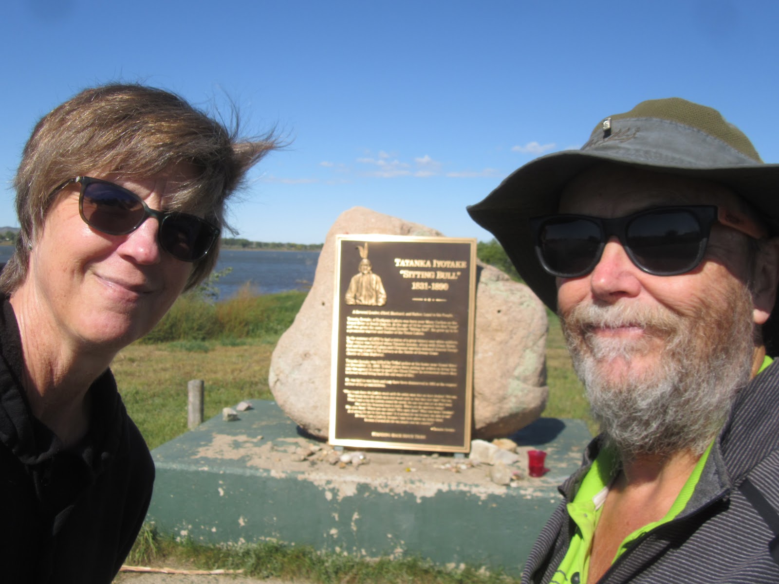
So, it turns out that Medora North Dakota is another vortex of history. Even before Theodore Roosevelt arrived, the Marquis de Mores, a wealthy nobleman from Europe, arrived and built his hunting lodge in 1883. While more rustic than what he was used to in Europe, it was still a plush 26 room home complete with a live-in servant staff of 6.

The home remains today in much the same condition as when the Marquis and his wife, Medora, lived here in the late 1800’s. She was quite the frontiers woman, able to outshoot him and most others that they hunted with. She loved hunting so much that she even hunted by herself when he was out of town. The Marquis established the town of Medora in 1883 when he built his hunting lodge, and of course, named the town after his wife.
The Marquis attempted to corner the cattle business, at least the part of getting it to market. The norm at the time was to drive the cattle back east to be slaughtered, or ship live cattle by rail. Either way, during the drive or the train ride, they could easily burn up half their body weight, or lose that much to damage from the jostling. De Mores built a huge slaughterhouse in Medora, and ran a railroad extension to the plant. But slaughtering the cattle in Medora and shipping in ice box cars to the East, he could easily yield more than 70% of the original weight and pocket the profits.
Unfortunately, easterners had begun consuming corn-fed beef raised in the East. Demand for range beef diminished just as de Mores’ huge plant was coming on line. By the early 1890’s he was losing significant money on the operation and shut it down. With no other reason to keep him in Medora, he and his family left. At the turn of the century all the buildings in the campus burned, leaving only the 84-foot-tall chimney.
We also visited the North Dakota Cowboy Hall of Fame. While this would be far more interesting a site if you were tied in with the local rodeo circuit and its famous rodeo riders, it was still a very nice collection of both local artifacts as well as things generic to the development of the 
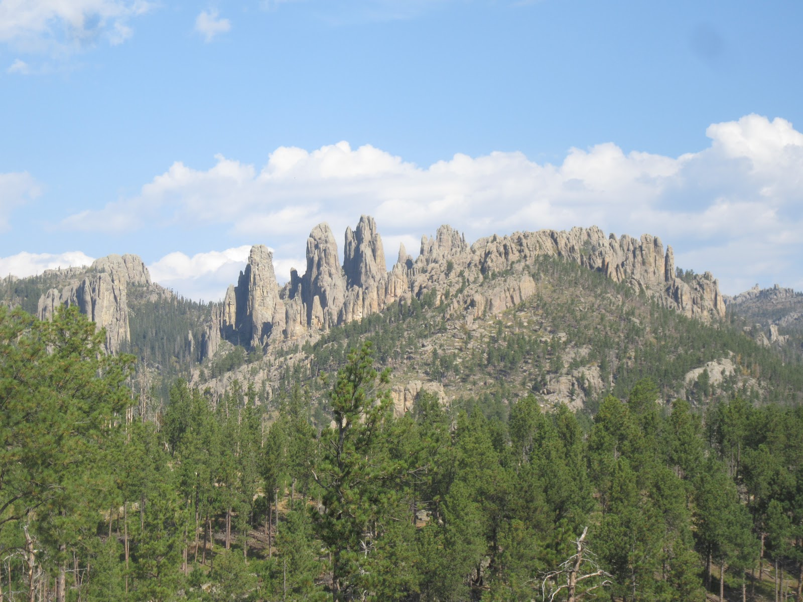
West to make it a pleasant visit.
We did one last hike in the National Park, to see the petrified forest. Apparently, Theodore Roosevelt NP has one of the best collections of natural petrified wood in the nation. Unfortunately, it had been raining off and on every day, so both the road as well as the hiking trail were muddy and greasy. We managed to make it out on the trail far enough to be among the significant petrified forest formations and get our curiosity handled.
I am not sure that the car or the bikes on the back of the car feel the same. I am not sure when either of them will get a good bath, but after this experience, they both need them.
Talk to you soon!

Wednesday, September 27, 2017

Theodore Roosevelt National Park

This turned out to be a great visit. We learned all kinds of things about the 26th POTUS that we never knew. For example, the power brokers in New York and the Republican Party feared Roosevelt as he was unrelentingly honest. So, they made him Taft’s Vice President, figuring that would keep him out of the Presidency. Little did they know that Taft would be assassinated and as a result, Roosevelt would become President.

The reason for the National Park (and in fact his presidency) is that on February 14, 1884, both his wife, who had given birth just 2 days earlier, and his mother died. His grief so overwhelmed him that he put his newborn daughter under the care of his sister and moved to a small cabin in the Badlands area of western North Dakota. His actual Maltese Cross Ranch cabin, built in 1883 during his first visit to the area, still sits just behind the visitor center at Theodore Roosevelt National Park.
Interestingly, apparently this cabin traveled nearly as much as the President himself. During his presidency, the cabin was moved to more than one world’s fair and exposition to be put on display. Later it was moved to the fairgrounds in Fargo, North Dakota, and then was moved to the state capitol grounds in Bismarck. In 1959, it was turned over to the National Park Service who moved it to the Park grounds about 7 miles North of its location in 1883. Many of Roosevelt’s original furnishings remain in the cabin, including his writing desk where he authored 3 major writings during the summers as
he grieved.
Maltese Cross Ranch was on the Little Missouri River. When he arrived in the summer of 1884 he also established Elkhorn Ranch, about 36 miles North, also along the Little Missouri. We hiked out to the site of this very large cabin, but sadly it is no longer there. If
you hike here you get a very clear picture of why the President loved this area, and found it so therapeutic. The only evidence the cabin was here are the foundation stones which still reflect the footprint and dimensions of this huge ranch home.
While we haven’t been stunned by the wildlife here, we did manage to stumble on some bison as we hiked in the South Unit of the Park.
The only other wi
ldlife we stumbled on were a whole mess of wild turkeys. They might be yummy, but man are they ugly!
Talk to you soon!

Monday, September 25, 2017

Some hidden Dakota treasures

We ventured North from Pierre to pursue some less publicized destinations. We drove an hour and a half to Aberdeen to the Brown County Fairgrounds. When we found out that the Whispering Giant given to South Dakota by sculptor Peter Wolf Toth was actually stored in a building on the fairgrounds, we assumed that we could not see that gem.

Luckily, a phone call to the fairgrounds proved us wrong. The folks managing the fairgrounds were more than happy to meet us and let us visit the sculpture. So, at 2 PM on Tuesday the 19th, we met Casey at the main entrance to the grounds. While a bit damaged, the management is working to find someone who could properly repair this gem. Despite the minor damage, it was well worth the drive.
We set out to find the gravesite of Sitting Bull. After visiting the Little Bighorn Battlefield, Wounded Knee and seeing Bury my Heart at Wounded Knee, we had to. The Army asserts they buried Sitting Bull at Fort Yates on the Missouri River in North Dakota. However, the Lakota and the Standing Rock Sioux don’t hold this opinion themselves.
Fort Yates is on the Standing Rock reservation. The Standing Rock Sioux are descendants of the Lakota, Sitting Bull’s nation. Lakota legend has it that a Lakota woman with a child on her back were turned to stone by the great provider. Believed sacred by the Standing Rock Sioux, this stone has been placed on a monument at the primary administrative offices of the nation.
After being buried at Fort Yates, the family of Sitting Bull assert that they removed his remains and moved them to where he was born, along the Missouri River near Mobridge South Dakota. On a bluff overlooking the Missouri on the Standing Rock Reservation, the view is amazing. While there has never been any scientific verification of the family’s assertions, we chose to believe.
Interestingly the family chose to relocate Sitting Bull in the year I was born, actual a few short 
months after I was born. The monument here is fitting of the great chief, with a sculpture befitting his stature and strength. Sadly, the grounds are not well kept, so visiting is an interesting dichotomy. A powerful monument in a fairly trashy setting.
While we were there some Native American descendants from Minnesota were also visiting the gravesite of Sitting Bull. We hadn’t bumped into them at Fort Yates, so we assume they are believers as we are. I couldn’t help but chuckle when I saw the sticker on the back of their Chevy.
It turns out that Sakakawea is also buried near the Sitting Bull gravesite. Perhaps I should say that the family of Sitting Bull likely chose the location to coincide with the gravesite of Sakakawea. Her monument is not nearly as impressive as that of Sitting Bull, but it was still impressive, and the views nearly as awesome. Sadly, the site of Sakakawea’s grave is even trashier than that of Sitting Bull, if possible.
Finally, as we reached the outskirts of Bismarck, we were able to quickly find the Whispering Giant that Peter Wolf Toth gave to the citizens of North Dakota. Yeah, two Toth sculptures in two days! Sadly, while very visibly displayed and looking oh so awesome, this Whispering Giant is in the parking lot of a liquor store knows as the Stage Stop.
Talk to you soon!

Saturday, September 23, 2017

Pierre South Dakota

What a fascinating town! Pierre is the capital of the state, and therefore is home to the 1910 capitol building. It has a population of only about 14,000 folk, so is tiny by city standards. But because it is the legislative center of the state, it has more services and amenities than you would normally find in a town of this size.


The total absence of security was astounding! We walked in the door of the capitol building and did not have to walk through any metal detectors or even talk to an attendant of any kind. The mansion of the Governor of the state is across a small lake from the capitol building. The grounds are not secured in any way, other than the small signs on the driveway that indicate that it is a “private residential driveway”.
We made our way to the confluence of the Bad River with the Missouri River. On September 24-28, 1804, the Corps of Discover along with Merriweather Lewis and William Clark reached this confluence. This was the Corps first encounter with the Lakota, known to them as the Teton Sioux. Because they had nobody who spoke Lakota, and the Lakota had no prior exposure to English, this first meeting resulted in a hostile battle. Lewis and Clark were able to quickly calm down the skirmish and eventually wrote in their diaries of a productive first encounter.
Pierre’s location on the Missouri is spectacular. We had lunch at a marina restaurant that was right on the river. The server was just beaming at how lucky she was to work there. She looked out the window at the Missouri, the highway of Lewis and Clark, and waxed about how she probably had the best view of anywhere in South Dakota. From what I can tell, I can’t imagine there is one better.
Deer at sunrise overlooking the Missouri River. We are staying at River View RV Park, and the RV Park could not have a more appropriate name. We have a panoramic view of what Lewis and Clark had experienced, however the bridges and buildings weren’t here in the early 1800’s.
We stumbled into Pierre – Fort Pierre to be exact, which is on the other side of the Missouri – on the weekend of their bicentennial. Apparently Fort Pierre was originally founded in the fall of 1917, and we scurried around all the bicentennial activities.  We also stumbled on the original site of Fort Pierre Choteau. A trading post built by John Jacob Astor in 1832, it quickly became the most strategic post in the Western Division of the American Fur Company.

Pierre continued to show us it has been a vortex of western development in the US. On March 30, 1743, Chevalier and Louis la Verendrye claimed the entire watershed of the Missouri River for France. To memorialize their claim, the Verendrye brothers buried a lead plate embossed on one side with their claim to the Missouri valley, and hand etched on the back with their names. The plate was discovered sticking out of the ground on this site by some high school students in 1913.


We learned that the National Park Service keeps website information on structures that are on the National Register of Historic Places, even if those properties are not under their management. We found the Brink-Wegner House in Pierre, built in 1904, a shingle style home that is one of the best period interiors in the entire state. Andrew Brink was one of the most prominent real estate brokers and contractors of the time. In 1923, Henry Wegner bought the home. It remains a private residence to this day.

I thought that Steve Wynn and the great minds that run the Las Vegas strip had all the angles figured out. But I guess you have to visit South Dakota to get an inkling into the way a casino property needs to be marketed. Genius!
Talk to you soon!

Thursday, September 21, 2017

BAdlands National Park

We were in awe of the Park. The Badlands were created originally as the accumulation of sediment on the ocean floor that covered South Dakota millions of years ago. Created by the millions of shells and mollusks the natural sand, the ocean bed was mostly limestone stone and sandstone. When the oceans left the area, the limestone and sandstone weathered over millions of years of high winds and rains, creating the unearthly landscape that exists today.

We learned that the erosion forces that created the Badlands are still at work today. The rangers indicated that while slow, about an inch of the surface of the Badlands erodes each year. Given enough time, it will eventually be just flat bedrock.
The formations are fascinating. Because they are layered sediment formed on the ocean floor, where they have been eroded away into spires they display each of the many layers that took eons to create. The brown layers, followed by yellow, rust, orange and many other shades are totally distinct and easy to pick out.
When the settlers first moved here in the mid-1800’s they attempted to farm this land. As you can see, there are tableaus of flat, fertile land that could be farmed, while not easily. At first those who came were able to hammer out a meager existence. However, the area only sees an average of 16 inches of rain a year, and the amount in any year varies significantly. It didn’t take many crops to deplete the nourishment in the soil, and soon, with crops failing, the settlers abandoned their land.
We visited the home of one such settler. Mr. and Mrs. Ed Brown filed a claim and received 160 acres of land here under the Homestead Act of 1862. In order to claim title to their land, the act required that they be age 21, build a house, and cultivate crops in a small acreage for 5 years. Unlike many of their neighbors, Ed and his wife were able to accomplish this herculean feat.
With limited timber, the settlers often reverted to building homes into the side of a hill, covered with grassy land. That is how the early settlers here got the name “sod busters’. The Brown’s current home was built in 1909, and still exists today in much the same conditions as when they lived in it. Most of the furnishings were actually those of the Browns, making it very eerie to tour. The Woman said if I ever made her live like this, she would have to kill herself!
Badlands National Park was a good visit and worth the effort.  And, bonus! We didn’t spark any wildfires here, at least none that we know of yet!
Talk to you soon!

Tuesday, September 19, 2017

We got lucky

Well, I screwed up big time. I really didn’t want to navigate through crazy Rapid City, and it looked like on the map we could just head East on smaller highways and make our way to Interior SD. Well, thanks to Rand McNally I managed to turn a 2 ½ hour drive into 4. But, it resulted in us being able to wander past the Wounded Knee battlefield, which I never would have found as I was building itineraries. This was where on December 29, 1890, the US Army decided instead to shoot Sitting Bull while taking him into custody, and massacred upwards of 300 Sioux men, women and children. It’s hard to believe that more than 20 of the US soldiers at Wounded Knee received the Congressional Medal of Honor for this shameful act.

We are in Interior because it is the nearest spot to the primary visitor center in Badlands National Park. We passed through here long ago with the kids, but have few recollections of the Park, and wanted to see it again.
And we’re glad we did! We had a wildlife extravaganza! When we visited Buffalo Gap National Grasslands visitor center in Wall, we learned about the plight of the Black Footed Ferret. This Ferret survives only because of Prairie Dogs – they eat them, and they use abandoned Prairie Dog burrows for shelter. When agriculture after the Homestead Act decimated the Prairie Dog population, the Black Footed Ferret was believed to have gone extinct. Miraculously, a small den was discovered in Wyoming, and have been successfully reintroduced into the Black Hills of South Dakota. Being nocturnal, we were lucky to even see one.
Driving through the park we spotted a Swift Fox. Another victim of agriculture, there were none left in the area, and their presence had to be reintroduced. Fortunately, the efforts have been fruitful, and the Swift Fox is now more plentiful, especially in the Park.
While the sight of Bighorn Sheep is not necessarily new for us, it is always a special treat to see one. It is rare to be ab
le to get up close and personal with one. This guy decided to see what all the commotion of the parked cars was about, not realizing that he, himself, was the commotion.
We’ve pretty much already seen as much wildlife on our first pass through the Park than on most of our trip so far!
Talk to you soon!

Sunday, September 17, 2017

Minuteman National Historic Site

This was both odd and a bit scary. It seems like a long time since the cold war and bomb shelters and “duck and cover”. But it wasn’t until Reagan was in office that we actually signed mutual nuclear arms treaties with Russia which at least put a temporary hold on the nuclear arms race. Now with Kim Jong Un (Mr. Nutcase), what is under the grasslands of South Dakota may be needed.

The cold war museum at the visor center is impressive. It essentially chronicles what the command bunkers were like at the nuclear missile silos, who occupied them (actual interviews with those crew as wells as written diary like entries), and how the center was on 24/7 readiness to push the button in the event of a Soviet attack. The interviews and accounts were chilling.
After the treaties signed by Reagan, the Minute Man I program was cancelled and all Minute Man I rockets were decommissioned. That meant removing them from their underground silos and removing their 1.2 megaton nuclear warhead. We visited Delta-09, one of 10 Minute Man I missile silos near Wall South Dakota, and could see for ourselves how the system was meant to work.
The Woman did not know that the US still has some 450 Minute Man III nuclear missiles in underground silos much like these in Montana, the Dakotas and Wyoming.  She assumed since we were looking at a decommissioned silo that they had all been decommissioned – oops! She was not particularly comforted knowing that what we were looking at, and the crew life we had learned about, was still in existence, but just had a different rocket inside.
Talk to you soon!

Friday, September 15, 2017

Omens

We are 5 for 6 now. We made our way to Wind Cave National Park. Established by Roosevelt on January 9, 1903, it is one of the earliest National Parks in the US, and is the very first National Park established to protect a cave system. Actually, it is the first cave based National Park anywhere in the world. Wind Cave is believed to be the 5th longest cave system in the world, believed to be in that only maybe 5% of the system has been explored and mapped, and its length is estimated based on measurement of air flow in the cave.

We toured the cave. It is known for what is called boxwork – calcite worked its way into cracks in the limestone, and when the acidic water ate away the limestone, the thin, fragile filled cracks remained. The reason for the name is that folk believed it looked like the maze of post office boxes where they picked up their mail. Allegedly 95% of the boxwork discovered in caves in the entire world is here in Wind Cave.
Wind Cave is a dead cave – there is very little water seeping into the cave and creating features at this time. But the mission of continuing to explore the cave carries on. Each few months the length of mapped caves changes, adding miles each year to the known stretches. Like Jewel Cave we visited a few days ago, there are only two active entrances to Wind Cave, making the exploration of it challenging and slow.
Adjacent to Wind Cave NP is Custer State Park. We had high hopes given the claims about the abundant wildlife here. We did see one pronghorn antelope, some wild burros and many prairie dogs, the buffalo were in pens and not roaming freely, and we saw nothing that knocked our socks off. It still was a nice drive and worth the effort.
Our favorite was the Pinnacles Highway. We drove in and amongst the rock formations, with 10 MPH curves, white knuckle overhangs, and views galore. It was spectacular! At an average speed of 25 MPH, it took us a bit to wind our way through, but it was well worth the time and the tension.
So, we have been accused of being the jinxes that are causing all the wild fires in the West. We visited Glacier NP, and now it’s burning and they are evacuating folk. The same Is true of many of the places we have visited, but none before this is as eerie. We left Wind Cave NP around 1ish – at 2 PM the same day, they had a lightning strike that set off what is now a 300-acre wild fire, and is still not under any level of control. Maybe it is us!
Other omens – we found gnaw marks in the pooches’ food and other containe
rs. We set mouse traps and left them in various spots around the coach. The Woman didn’t hear the SNAP in the middle of the night, but I did. Hopefully, the other 5 traps I set out will yield no bounty.
Today’s road was not kind – when we drove to Alaska they warned us about porpoising on the ice heaves – in the Lakota land on the BIA (Bureau of Indian Affairs) highways, it was worse than Alaska. We made it in one piece – so we thought. When we opened up our slides, we heard CRACK CRUNCH and lost a closet door, as well as a smashed CD drive for our laptop. I guess it could have been worse.

Talk to you soon!