Sunday, October 19, 2014

Moving on to Vermont

We thought that maybe we had hit peak fall colors while we were in Franconia New Hampshire. Well, we might have, but we learned that the timing of peak colors changes as you move about. We headed to the world famous ski resort town of Stowe Vermont. As we headed a bit West, we found that maybe the colors here were still at their peak, where when we were leaving Franconia, it was pretty clear that the peak was just a bit behind us.

Vermont is wonderful. Every turn in the road has a historic looking farm with silos poking into the skyline, and behind the farm and silo is a hillside with a blanket of fall colors. It seems like you would get numb to this after a while, but no – the next one is just as beautiful as the last. You don’t seem to ever tire of the beauty.

Our first stop was the Ben & Jerry’s factory for a tour in Waterbury Vermont. We learned a bit how the two college buddies, Ben Cohen and Jerry Greenfield, who threw their money together in 1977 and enrolled in a correspondence course on ice cream making from Penn State University. Upon completing it, they started the Ben & Jerry’s Ice Cream Company in a garage in Burlington Vermont in May of 1978. Although selling the company along the way to an international conglomerate, they have managed to retain the corporate culture of making only premium products using sustainable and fair trade ingredients.

In touring the plant we got to see them making Vanilla that day, still one of their biggest sellers. We learned that while this building was the original factory Ben and Jerry built to expand operations from their garage in Burlington. We also learned that there is a Ben & Jerry’s ice cream plant in our home town of Henderson Nevada – had to come all the way to Vermont to learn that! Of course our tour ended up in the original development kitchen where Ben and Jerry would create their most famous flavors, and were treated to a nice scoop of strawberry cheesecake ice cream – even I made an exception for that.

After the fun tour we visited the Ben & Jerry’s Flavor Graveyard. It was really a cute idea, one that only a company with a culture like this would come up with. Because they try to introduce maybe 30 or so new flavors a year, they of course have had to cease production of many of the flavors that have been introduced over time.

Each time that the production of a flavor ceases, a tombstone is erected in the Flavor Graveyard. The tombstones are brightly colored as in the Ben & Jerry’s culture, and each has an epitaph in keeping with the whimsical corporate culture. We couldn't help but read them all before we were done.

Touring the Ben & Jerry’s Factory feels a lot like being on a Southwest Airlines flight – the folk working there all seem to be having a blast, and there is a constant level of irreverence in their communication, including our tour guide. She capped of her irreverence when we entered the kitchen and lined up for our free sample – here is what the poster on the tasting counter said our flavor of the day would be!

Next we visited Maple Grove Farms, also in Waterbury, one of the biggest distributors of maple products in the US. We learned about the production process all the way from the maple tree to the market. What I didn’t know is that there are four distinct grades for pure maple syrup. Grade A Fancy is a very light amber color and mild maple flavor – from there the grades go to Grade A Medium and Dark, and finally Grade B, each with a darker amber appearance, and a more and more pronounced maple flavor. We got to sample all the grades at the factory store, as well as a sampling of their premier maple sugar candy – yum!

We visited Stowe Ski Resort and grabbed a cheese plate and a couple glasses of wine while we played Zar and gazed at the gondolas climbing the slopes. There is just something special about a world class ski resort, and we really enjoyed this time.

We jogged over to Burlington, the largest city in the state. With a metro population of over 200,000, it may hold about a third of the population of the entire state. Burlington is on Lake Champlain, named for Samuel de Champlain who discovered it – at least as far as white Europeans are concerned – in 1609. In the early 1800’s, the construction of the Champlain Canal connected the lake with the Hudson River system and allowed ocean traffic into the lake. We had a nice walk around town and hit the Church Street historic pedestrian mall, set up to hold all their higher end retail development.

We never did find the original Ben & Jerry’s garage where it all started, but we still had a great visit.

Talk to you soon!

Friday, October 17, 2014

The Woman is all about the AT

The Woman got hooked on reading books written by folks who hiked the Appalachian Trail. If you are heading North, the AT starts in Springer Mountain Georgia, and ends in Mount Katahdin Maine, about 2,200 miles later. After reading maybe a dozen of these books, the Woman has become somewhat Appalachian Trail possessed.

So, it turns out that the AT runs across the Presidential peaks in the White Mountains. So the Woman demanded that we had to seek out where we could get access. We were able to find several spots where the AT either crossed or shared a trail that we could get to in the White Mountain National Forest. So we set out to hike as much of the AT as we could get to.

We found out a good reason for one of the statistics that the Woman had learned in reading all these books. When we actually found connections to the AT and set out to hike some of it, we were immediately surprised by the severity of the terrain. The trails we hiked were narrow, extremely steep, if not totally full of rocks, they were saturated with exposed tree roots – what we would consider an advanced or “scrambling” trail. To think that folk hike this with maybe 200 pound packs on their back, and set out to click off 2,200 miles makes the stat understandable that some 75% of folk that set out intending to do the complete AT quit before they reach 100 miles.

So, we probably clicked off a total of maybe 5 miles on the AT. It is pretty clear to us that while the thought of it is intriguing, given what we have learned about the terrain tells us that we won’t likely check this one off the bucket list. We did find a couple of hostiles that are frequented by those hiking the entire AT – referred to as “through hikers”. We also found a number of classic AT shelters where through hikers would either find shelter in bad weather, or would actually hole up for the night when far from a hostile or other arrangements.

Hiking the AT, we were able to find the clues that help keep the through hikers focused. I learned a new word that I added to my vocabulary and have deliberately used a lot just to reinforce it – the word is “blaze”. The first time the Woman said it, I didn't have any idea what it meant, or how to spell it. It turns out that the way you make sure that you stay on the AT, particularly in rocky areas where the worn trail may not be visible, is to follow the painted white rectangles that are painted periodically on tree trunks. They are a bit apart, but if you make it a habit to look for the white “blaze” on the next tree, you will be able to keep dedicated to the AT.

There are short cuts on the AT where you can cut off some of the miles, and there are off shoots where you can get to a town or hostile or something like that. Those trails are marked with blue paint rectangles. If you take those shortcuts or offshoots, you are said to be blue blazing.

We actually bumped into a couple of through hikers in a couple spots – the most fun was on the top of Mount Washington near the station for the Cog Railway. It turns out that the AT climbs directly over Mount Washington, the highest peak in the North East – just to give you an ideal how devilish this trail is. We learned that we weren’t seeing too many through hikers because the snow would be falling soon. So, if you were in Vermont right now, you probably wouldn’t make it before it was impassable. So, most through hikers passed by here a month or so ago at the latest.

While we hiked on both white and blue blazed trails, we never found a pink blazed trail. I guess there really aren't any pink painted rectangles out there, but if you read the books the Woman did, you would learn what pink blazers are. Apparently if you are a woman and have the sheer guts to hike the AT by yourself, you are said to be pink blazing.

Talk to you soon!

Wednesday, October 15, 2014

Franconia too

We scoured Franconia Notch State Park. The Flume is a naturally formed crevice in LaSalle Mountain that funnels water in beautiful and interesting ways through centuries old glacial rock – primarily basalt. The formations were spectacular, and also allowed us to a few mile hike in a lovely setting – bonus!

The Basin is another feature in the Park on the Pemigewasset River – Pemigewasset is Algonquin for swift, and this river meets that definition. Henry David Thoreau visited the Basin in 1839 and wrote that it was “perhaps the most remarkable curiosity of its kind in New England.” The Basin is an immense granite bowl, carved out by the Pemigewasset over centuries to form this interesting feature. We stood and looked at the Basin from where Henry David Thoreau did in 1839.

We hopped on the Cannon Mountain aerial tram to the top of Cannon Mountain – about 4,100 feet in elevation. It was a great ride up – the weather on the top was spectacular – we hiked the trail to the overlook – it was spectacular! Interestingly, I thought that the fall colors would be so cool from up here, but actually we were too high up to enjoy its intensity. It was beautiful, but looked more like a multi-colored blanket – you actually needed to be closer to see the definition of the trees and their leaves.

The tram station on the peak had a cafeteria that serves the ski crowd in the winter and folk like us in the non-snow time. We had a couple of yummy sandwiches and I decided to take advantage of the highest tap in the state of New Hampshire – they actually had a local brewery create a signature IPA for the mountain – the Cannon Mountain Ale – so I couldn't pass that up. We bellied up on a couple of tall stools to the window, ate our sandwiches, sipped our ale, and watched the goings on in the Franconia Notch 2,000 feet below.

We visited Boise Rock, where I learned there are really no new ideas – just circulated ones. Named for Thomas Boise, a noted teamster, who in the early 1800’s was sledding through the Notch in mid-winter. Overtaken by a severe snowstorm, he was unable to continue. Realizing he had to take drastic action to survive, he found this rock overhang. In his desperation, he killed his horse, cut it open, and crawled inside the hide to use its warmth to keep him from freezing, and he survived the storm. And all this while, I thought George Lucas had come up with a new and unique idea when Han Solo found Luke Skywalker freezing outside the shelter on the planet Hoth!

While we were here, the Woman’s pen pal through most of her life happened to be in New England. Sarah Swallow lives in Chester England, and Sarah and Robin were pen pals following in the footsteps of their moms, who were also pen pals with each other. Sarah’s husband, Melvin, is an exceptional white water racer in a kayak, and won the international competition that was held in Oklahoma City in September. Afterward, they headed to New England to get with dear friends that lived in New Hampshire. So, they kindly carved out a couple days to stay with us while we were here. We hiked and talked all the while they were here, making sure all our hikes were along creeks that had gorgeous waterfalls at the end – hours of nice walks with plenty of time to talk and catch up, and then with a great reward at the midpoint – what could be better!

We hiked through the Lost River Gorge. Not unlike the Flume but beautiful in a slightly different way. And along the gorge, there were a half dozen or so caves that you could crawl through if you were up to it. Some of the caves were so tight that they even had gauges outside the caves so you could make sure you actually could fit in before you crawled down inside.

We took Sarah and Melvin hiking over the top of Bald Mountain to the rock outcropping known as Artist Bluff. The Bluff is an absolutely special spot – immense relatively flat granite boulders overlooking the Notch from the North. You are suspended out nearly over the I-93 corridor which is smack in the center of the Notch, and you have a panoramic view down the Notch to the South. From the Bluff you nave great views of Echo Lake below, Cannon Mountain and its ski area, and all the Presidential Peaks in the White Mountains that line the Notch. Most of the mountains in this range have been named for former US Presidents.

As we stand there and gawk at the sheer beauty, we are beginning to think that maybe we are in the midst of the peak of the changing fall colors. While only a little time with confirm or deny, it seems like the brightness of the colors have reached an intensity that it seems unlikely could get any better. We shall see.

The next day we dragged Sarah and Melvin up the Copper Mine Trail to Bridal Veil Falls. The Woman and I had hiked the 5 miles up and back a couple days ago, and really enjoyed the trail along the creek – nice forest trail with nearly constant cascading water sounds soothing your journey for you.

It had rained yesterday afternoon – not hard rain but steady. At first I didn't think that it had impacted the creek. But then we came to a spot in the trail that I had a visual image of, and something was wrong.

When the Woman and I had been here a couple days ago, we saw 6 symmetrically placed pipes embedded in a rock face that the creek was flowing around. Some hiker had places a large flattish boulder on the top of each of the 6 pipes so that they took on the appearance of mushrooms. Well, today there were only 5 – odd! Well, on closer inspection, I realized that one of the 6 pipes, along with its boulder, was completely submerged under the swelled up creek. Apparently the water level in the creek had more than doubled due to the rain.

When we finally arrived at Bridal Veil Falls, the additional water volume jumped out like a sore thumb. While the Falls had been beautiful a couple days ago, today they were simply dramatic! The water crashing down through the deep crack in the wall was, again, more than twice the volume we had seen. And the boulder bed that it crashed onto directly at our feet was completely awash where only a couple foot wide stream of water had been there before. So, not only was it a nice bonus for Sarah and Melvin on an otherwise nice hike, it ended up being a total bonus for me and the Woman as well.

Talk to you soon!

Monday, October 13, 2014

Shortest leg ever!

We enjoyed our stay in Lincoln, and headed out on our trek to Franconia. When I plugged our destination into the bitch, she beeped and said we would arrive at our destination in 17 miles. I assumed that there was something wrong with the destination point we had loaded into her in advance, but no, it turns out that she had the right destination. The woman had routed us to travel to and stay just 17 miles from where we were going!

The short drive between Lincoln and Franconia was some of the most beautiful we have ever driven. The stretch is referred to as the Franconia Notch, a narrow path between two mountain ranges that parallel each other. The passageway is so narrow that I-93 that goes through it slims down to one lane in each direction, and the speed limit was reduced to a casual 45 MPH. With the fall colors clearly in bloom on each side of us, we made our way through the Notch – a path that we would be happy to travel many times as we explore the area further.

We learned that Franconia may be one of those warps – here are some of the firsts:
·         Long before steel in Pittsburgh, iron was mined near Franconia. As early as 1805, maps of the Franconia region showed the location of the granite blast furnace where the locally mined ore was smelted into iron. The only original furnace to still exist in New Hampshire long after the ore played out is here.
·         Franconia was the location of the first organized ski hill in the US. Cut in 1933, the first racing trail in the US was the Taft Slalom. Franconia again gained more recognition when the first aerial tram in the US was built at Cannon Mountain Ski Area in 1938.
·         The oldest ski club in the US, the Nansen Ski Club, was founded in 1872 outside Franconia.
·         The first ski school in the US was established near Franconia in Sugar Hill in 1929.
·         Polly’s Pancake Parlor, prominent in the 1,000 Places to see before you die book, has been serving outstanding pancakes with natural New Hampshire ingredients for over 75 years. The woman had cinnamon maple walnut pancakes – I had two eggs, maple smoked bacon, and maple smoked patty sausage – yum!

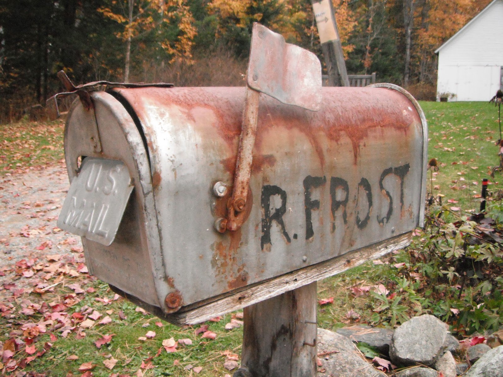
·         Robert Frost, one of America’s premier poets, got much of his inspiration from New Hampshire. Frost moved here in 1915 and bought a farm overlooking the Notch, and owned it for 10 years. At first, American critics and the public did not accept his work, and he could not get published. He went to Oxford in England and studied, acquiring some new insight into his craft, and in that time he published two books of poetry in Europe that were energetically received. He returned to Franconia and rented the same home he had lived in, and published more books in the US, becoming one of America’s most beloved poets, getting his poetic insight from much of what he experienced in New Hampshire.
We toured that home, walked the grounds that he used to walk, viewed the views that used to inspire him from his home and front porch, and watched a very insightful video about his life and his time in the State. We really enjoyed this visit.
·         Nearby at Mount Washington was where the first cog railroad was built in the US in 1869. Hiking trails to the top of the highest peak in the Northeast at 6,288, Mount Washington has always attracted attention. In the early 1800’s folks hiked to the impressive summit, and in 1853 by Samuel Spaulding built the Tiptop House to house those hardy souls who ventured up to the summit. In 1868, Sylvester Marsh petitioned the New Hampshire state legislature to build a cog railway he had envisioned to the summit. The NH legislature said that since he was backing the project with his own money, they would grant him the authority, but that since building a railroad to the top of Mount Washington was impossible, they might as well grant him authority to build a railroad to the moon!
Of course, Marsh accomplished his dream, and in August 1868, President Ulysses S. Grant and his family road the cog railway to the summit of Mount Washington. That same cog railway system is still in use today. The line is 3 miles long, and climbs 3,600 feet to reach the summit.

We chose to drive the Washington Mountain Auto Road. A 7.6 mile road that essentially accomplishes what the cog does was established in 1861 as a carriage road to reach this obviously sought out summit. When this carriage road was officially opened, it allowed folks who would otherwise have had to hike to see the summit to ascend in the relative comfort of private carriages – although I question the word “comfort”. Mount Washington is the site of the record recorded winds in the US at over 231 MPH, which is why the buildings at the top are literally chained to the mountain!
When we started up this narrow, nail biting road, the mountain was completely clouded in, and we were driving through a white out – not fun! But we eventually came out of the clouds, and it was bright sunshine above. We were surprised, however, to find out that when we reached the summit, the clouds had blown out and we had an unfettered view of the valleys surrounding Mount Washington. The views were spectacular – we had lunch in a couple of Adirondack chairs right on the bluff edge – to die for. After lunch, we visited the Tiptop House which still exists – the oldest structure on the mountain. It’s awesome to know you are walking on the same grounds as President Grant and others from over 200 years ago.
We hiked around as much as we were up to on this summit. The Appalachian Trail crosses the Mount Washington peak, so we sought it out. We found it, and found that excited through hikers had placed a number of hoodoos – not too surprised!
·         Bode Miller, the Olympic medalist in downhill, did most of his developmental training at Cannon Mountain Ski Area. The New Hampshire Ski Museum displays many of Bode Miller’s medals, and gives insight into the development of the skiing industry in the US. In addition, the museum displays the earliest ski lift equipment in the US as well as one of the original gondolas from the 1938 aerial tramway.

While not as far from Lincoln as I thought, Franconia has turned out to be a great destination in our travels of the Northeast. We love New Hampshire so far!

Talk to you soon!
Saturday, October 11, 2014

Lincoln New Hampshire

We needed a couple days before we could get into the RV Park we were headed to in Franconia, so we decided to stop in Lincoln New Hampshire. The Woman’s best friend recommended a fun campground there, and there was plenty to do for a day, so we decided to make that our stop to kill a couple days.

On the way, we stopped at a gem in Manchester NH. The Currier Museum was the creation of one of the early wealth residents of Manchester, the Currier family. This turned out to be one of the best small museums we have ever been to. In their small but diverse collection, we saw paintings by Van Goff, Picasso, da Vinci, Monet and Matisse, as well as Georgia O’Keeffe and sculptures by Remington and a cast of other famous artists. They had an extensive collection of 17th and 18th century furniture and housewares, including silver tankards crafted by Paul Revere, and his father who was also apparently a silversmith, and other notable names. It is a really fun visit, and the contents clearly impress.

The other interesting think in this museum’s collection is one of only two Frank Lloyd Wright homes in New Hampshire – they happen to be almost next door to each other. The Zimmerman House was built in 1950 for Dr. Zimmerman and his wife. Wright referred to this particular type of design as Usonian, apparently referring to the new world character of the design and landscaping. On her death, Mrs. Zimmerman left the home to the museum along with some funds to maintain it for some time. It is now an important part of the museum’s collection.

We toured the home, which was interesting. The front facing the street looks almost ugly – that is because Wright focused all his design on the side of the home facing the yard and living area. He created an almost completely glass wall on that side, which almost makes the yard and the home appear to run together – it is really fascinating. Because Wright tended to design his homes as well as the furniture in them, the home is almost exactly the way it looked when the Zimmerman’s lived in it – Mrs. Zimmerman even left most of their housewares to the museum as well. The Zimmerman's even left themselves there - their remains are buried in the back yard.

We had seen one of Wrights homes in Scottsdale Arizona – Taliesin West – out in the great outdoors surrounded by desert and rocks and mountains. While some of the features were recognizable from other Wright homes we have visited – built in furniture and the mingling of living and dining and entertaining spaces – it was quite interesting to see a Wright design in a fairly dense urban setting. We thoroughly enjoyed touring the home – a piece of art itself.

Lincoln is at the base of the infamous White Mountains, and the fall colors were beginning to blanket the slopes with a quilt of brilliant yellows, oranges and reds, with many other shades thrown in just for good measure. We headed into the heart of the Mountains on the Kancamagus Highway, a popular scenic drive any time of year, but packed when the fall hits.

At the White Mountain National Forest visitor center in Lincoln we got some good hiking information, and headed right to the Lincoln Wood Trail parking. The Lincoln Wood Trail is a 3 mile long stretch of reclaimed rail bed – read that 300 feet of elevation gain in 3 miles – nice! However, unlike most of the reclaimed rail bed trails we have been on, they forgot to remove the old ties, or decided just to abandon them as not being worth the effort to remove. Good news is that for most of the way you could walk on either side and avoid having to step over them all.

When we got to the end and added another 2,000 feet, we were rewarded by the roaring cascades of the Franconia Falls. We love hikes any hikes that don’t require extreme scrambling, especially when they have such a nice reward at the end.


Talk to you soon!

Thursday, October 9, 2014

Portsmouth New Hampshire

On our way to Portsmouth we stopped to visit the Lowell National Historic Park in Lowell Massachusetts. In the early 1800’s Lowell was identified as an attractive industrial city for much the same reasons the DuPont’s selected the Brandywine Valley – water power for factories. In 1803, progressive industrial leaders had already completed the Middlesex Canal, linking the abundant water supplies of both the Merrimack and Charles Rivers to fuel the industrial development and provide necessary transportation within the city. By the end of the century, Lowell had established itself as the textile mill for the Nation, almost completely eliminating textile imports from English textile mills.

Lowell was at the apex of a number of movements in the US society, and the NPS has done a great job of touching on all of those movements. The sad news is that by the early 1960’s, off shoring of textile manufacturing wiped out the economy in Lowell and the last factory closed. The good news is that the buildings and infrastructure was still in place and some of it frozen in time for all to explore. The movements - the dawn of the modern industrial era in the US as well as the model for the manufacturing management systems still in use today – because men were deemed as needed in other endeavors, the Lowell factories provided some of the earliest full time job opportunities for women, with factory owners actually setting up company housing for the throngs of young women flocking to Lowell – eventually as Lowell’s success resulted in more textile mills, resulting in more supply, resulting in decreasing prices due to competition, pressures on employment resulted, with greater demands for production, longer work hours, and cuts in pay. Ultimately, all these pressures were at least part of the spawning of the labor movement, the Union movement, and the demonizing of corporate America.

We toured one of the many textile mills, that still looked like it did at the turn of the century – all the equipment still in place, running off a central belt drive just like the DuPont facilities – originally, at least, powered by water only. We got to visit one of the worker housing units refurbished as it looked at the turn of the century. We strolled along the many canals that provided both the water power and industrial transportation back in the day, and grabbed a nice lunch at an outdoor patio cafe. All in all, it was a look into the early industrialization of the US put together in a way really allowed you to feel like you were there at the time.

After Lowell, we rolled onto our next destination.Incorporated in 1653, Portsmouth in its heyday was a gem – even bigger than Boston. On the mouth of the Piscataqua River, it had direct access to the Atlantic shipping trade, but was a well-protected harbor. Its unique and advantageous location made it ideal for the first federal shipyard, the Portsmouth Naval Shipyard, established in 1800.

Our primary destination was Strawberry Banke Historic District. When Portsmouth was first settled, it was called Strawberry Banke, named for all the wild strawberries growing in the area. In the early days, directly behind the long docks where the tall ships would come into port and offload their cargo, there was a small narrow waterway known as Puddle Dock – deep enough at most times for barge traffic but not deep enough for sailing vessels. The Puddle Dock neighborhood is the earliest in New Hampshire settled by Europeans – ship captains and wealthy merchants built their homes along the waterway as they then had direct access to the shipping docks, and could easily transport goods and valuables between their homes/businesses and the shipping piers.

After Portsmouth shipping was no longer the dominant business in the late 1800’s, the area fell into economic blight. The beautiful old homes were converted into tenant housing and the area became more or less a slum. Around 1900, the city decided to eliminate the waterway and hauled in massive amounts of fill. Because the area was really not deemed as valuable enough for development, the homes here were never demolished to make way for progress, and most still stood when the city decided to renovate the Puddle Dock neighborhood and create the Historic District.

We toured the homes of sea captains and wealth merchants from the 1700’s. All the homes in the neighborhood are pre-revolutionary, with one dating back to 1695, the oldest in the Puddle Dock neighborhood. About half the homes were furnished with some actual furnishings owned by the original families and with period pieces where original furnishings were just not available. The other half of the homes were either restored by unfurnished so you could see what the impact of the early 1700’s architecture looked like, or on display in a pre-restoration state with some openings in the floors, walls and ceilings so you could see exactly how they were originally constructed. Local historic experts or docents in period costume were in nearly every building to either provide details or give you a flavor of what it would have been like to be here when it was an English colony.

Our last home visited was that of one of the leading merchants. The historian there had a period map of the neighborhood, and was able to give us an excellent perspective. While now the back of the merchant’s home is on a large grassy common area, in the 1700’s it was on Puddle Dock with a small pier off the back where he tied up his barges. He pointed out where the tall ships would dock – maybe a couple blocks away. We could see all the homes that surrounded this grassy common area and realized that was the waterway the city had filled around 1900 – before the revolution, homes surrounded the waterway the way they now surround the grassy common.

We walked up the street to the John Paul Jones Home. Captain John Paul Jones – the “I have not yet begun to fight” guy, didn’t own the home, but he lived here for a couple of years to supervise the building of the Ranger – the war ship he was to captain. The home was built in 1754, and while not his, contained a number of artifacts used by the famous captain. We also learned a great deal about John Paul Jones that we didn’t know – he was of Scottish birth, he was often crosswise with the political leaders of the time, but his naval success in attacking the British earned him acclaim and the nickname “Father of the American Navy”.

As in other places on the coast we have been lately, although our destination is in New Hampshire, Colectiva is actually sitting in Maine – York Harbor Maine to be exact. This is a great town with a gorgeous coastline – a large dramatic crescent on the Atlantic, flat sand in the middle sandwiched on both sides by dramatic dark glacial boulders – really pretty. The beach turned out to be dog friendly, so the Woman, the pooch and I got in three last beach walks which would have to hold us for a while until we can get back to an ocean again.

We managed three more small victories before we started our move inland to catch the fall colors – we are actually quite pleased with the splashes of color we see from time to time already, although the locals tell us it won’t be peak colors here on the coast until the end of October:
·         We headed out to Nubbles Lighthouse. On Nubbles Point just out from the town of York Harbor, it is a small lighthouse still in operation. We thought it was on the mainland because it looked that way from town, but when we got there we learned it was on a small island. We found Bob’s Lobster House, with huge plate glass windows looking out on the lighthouse and the cove, and enjoyed ourselves with a glass of vino and playing some Zar as we soaked in the view.
·         About a block from Colectiva was Lobster Cove – a restaurant specializing in lobster that advertised a $15 lobster dinner – I like the tail, but not all the other stuff, so I wasn’t thinking I was up to paying $35 for a Maine lobster dinner, but at this price? The views were nearly as good as at Bob’s, and the lobster was outstanding – it even came with a gorgeous ear of fresh corn on the cob, and a baked potato which the Woman scarfed. What a deal!
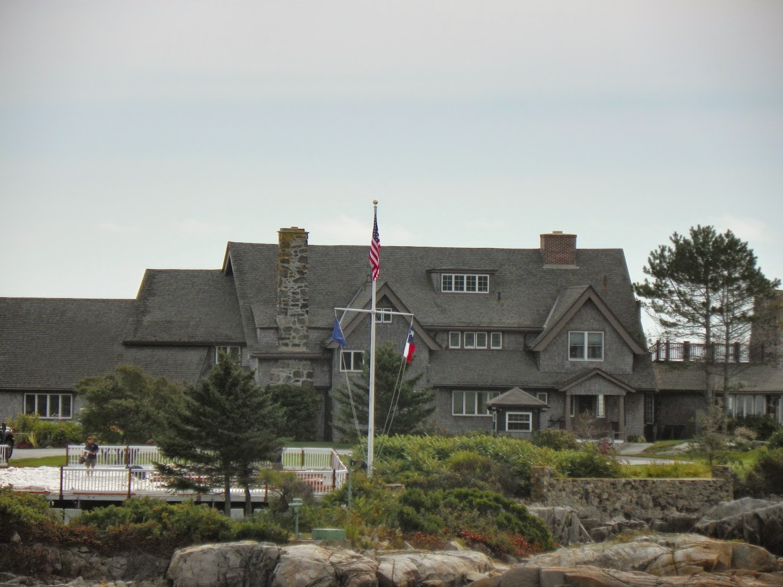
·         And since we were only about 20 miles away, we scooted up to Kennebunkport before we left. The town is cute and we walked around a bit – very busy – saw at least 4 tour buses parked. If you drive way down to the end of Ocean Avenue out to Walker Point, there is a small pull off were you get a bird’s eye view of the Bush family compound. We didn’t happen to see any of the Bush family roaming around the grounds, but it was fun to see nonetheless.

Talk to you soon!