 After US
129 and the Tail of the Dragon, I wanted to check out more of these historic
mountain highways. The Devil’s Triangle is a 44 mile loop with some of the
sharpest and steepest switchbacks you will ever experience. It is billed as
being much more of a challenge than the Tail of the Dragon. We enjoyed
exploring the Triangle, but found out that because it is not adjacent to
Gatlinburg and Pigeon Forge and the Smoky Mountains, it does not seem to
attract all the higher profile activity and attractions we experienced at the
Tail.
I could
see that this would be a really fun ride on a Harley, or anything on two
wheels. But from a tourism viewpoint, the area is really depressed. The towns
had little to offer other than boarded up and vacant buildings, and there were
no real attractions to draw in crowds. Even though it was a weekend, we saw a
total of only 30 Harleys on the Devil’s Triangle, compared with the many
hundreds we experienced while driving the Tail of the Dragon. And we saw not a
single stealth camera blind on the way. However, we really enjoyed the ride.
 Oliver
Springs is typical of the towns along the Devil’s Triangle, except that it may
have had a few more buildings (abandoned of course) of substance than the other
towns around. We had no idea why there was an RV park in Oliver Springs – we
assumed it might have been the draw of the Triangle. We were wrong. Apparently
this is a hot spot for off road ATV aficionados. It turns out we were actually
lucky to be able to get a site.
Oak Ridge
did not provide any entertainment. For all the reasons I mentioned before, Oak
Ridge became the primary location for the Manhattan Project, established there
on August 13, 1942. Apparently back in 1942 the town didn’t even show up on
maps it was that top secret. I expected there to be something to remind folk of
what may have been one of the most significant war effort in history, but I was
wrong. Other than a few street names like Centrifuge Boulevard and such, and a
museum dedicated to atomic science, there was really nothing to commemorate the
Project here.
 We did,
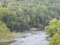
however, stumble on a gem while doing the Triangle. When in Cataloochee Valley
we picked up a National Park brochure for the Obed National Wild and Scenic
River. Because of the preservation of the National Park Service, the Obed River
valley is pretty much as it looked in the 1700’s when European settlers
arrived. The National Park Service manages over 45 miles of natural bluffs
along the Obed River, Clear Creek and Daddy Creek.
We hiked
out to the Lilly Bluff. Lilly Bluff is one of the dozens of dedicated rock
climbing areas available to users of the park. Also, at the base of Lilly Bluff
is one of the many rapids that make up the challenging white water canoeing
available in the park. Cataracts ranging from level 2 to level 4 rapids make
this a haven for those who love to hit the white water.
 Since we
had extra time, we decided to hike out to The Point, a thin pinnacle high over
the Obed River on one side and Clear Creek on the other. The Point is where the
confluence of these bodies of water occurs.
This is
the second time we hiked to the confluence of two rivers – the first time was
to the confluence of the Green and Colorado Rivers in Canyonlands National
Park. However, today’s hike was only 4 miles round trip to The Point, as
opposed to the 26 miles round trip in Canyonlands!
We were
really happy we stumbled upon this gem that we wouldn’t have otherwise known
about.
No comments:
Post a Comment