 Intersection of Jenkins and Hocking Streets was the first
discovery of gold in the area. George Knight was on a Grass Valley hillside in
October 1850 when he came upon an outcropping of white quartz rock laced with
yellow. He pounded the rock with his cast iron skillet and washed out the gold.
Digging under the outcropping he discovered a 4 inch gold vein. Named the Ophir
Vein, the race to Grass Valley was on.
Intersection of Jenkins and Hocking Streets was the first
discovery of gold in the area. George Knight was on a Grass Valley hillside in
October 1850 when he came upon an outcropping of white quartz rock laced with
yellow. He pounded the rock with his cast iron skillet and washed out the gold.
Digging under the outcropping he discovered a 4 inch gold vein. Named the Ophir
Vein, the race to Grass Valley was on. After the mining claim changed hands several times it
ended up in the hands of William Bowers Bourn in 1869. The mine was highly
successful, and in 1897 he commissioned Willis Polk to build what he would call
his “Cottage” using waste rock from the mine. By the turn of the century he
added a clubhouse with tennis courts, a bowling alley and squash courts.
After the mining claim changed hands several times it
ended up in the hands of William Bowers Bourn in 1869. The mine was highly
successful, and in 1897 he commissioned Willis Polk to build what he would call
his “Cottage” using waste rock from the mine. By the turn of the century he
added a clubhouse with tennis courts, a bowling alley and squash courts. 
We visited the mine and the Cottage. Sadly the Cottage was being refurbished and was not open for touring at this time. However we thoroughly enjoyed our visit. Between 1850 and 1956 when the mine permanently closed after a debilitating strike, the mine no less than 5.8 million ounces of gold. The Empire Mine is one of the oldest, largest, deepest, longest and richest gold mines in California history.
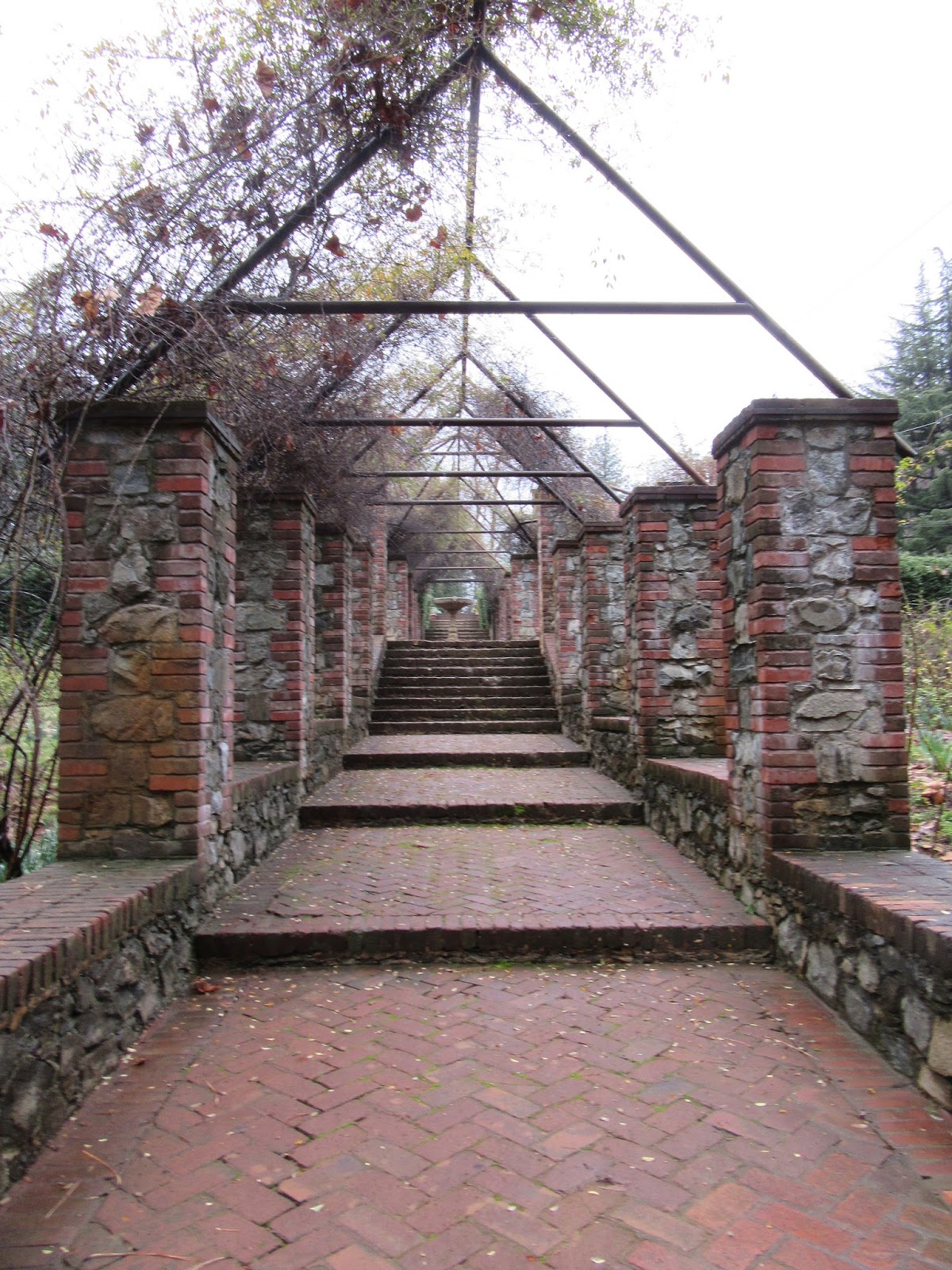 My expectations for the visit were modest, but I was
really pleasantly surprised. The grounds have been maintained both in the
structures and the layout in the way it would have been when the Bourn family
lived here. The visitor center has a great overview that was filmed in the 50’s
when mining in the area was still being done. The perspective was outstanding.
We had seen different kinds of mining going on in Alaska, the Yukon and
elsewhere and historical equipment often used – pans, shaker beds, sluice
boxes, hydraulic jets and dredges.
My expectations for the visit were modest, but I was
really pleasantly surprised. The grounds have been maintained both in the
structures and the layout in the way it would have been when the Bourn family
lived here. The visitor center has a great overview that was filmed in the 50’s
when mining in the area was still being done. The perspective was outstanding.
We had seen different kinds of mining going on in Alaska, the Yukon and
elsewhere and historical equipment often used – pans, shaker beds, sluice
boxes, hydraulic jets and dredges.  However, I never pieced together that these
were not just different ways being used in different places – rather they were
gradual improvements in technology. Pans were slow and back breaking – lead to
shaker boxes to accelerate the refinement of the gravel, which then had to be
panned. Sluice boxes were just large shaker boxes with more automated water.
Hydraulic nozzles accelerated the scouring of the land and moving the tailings
into what was essentially just huge sluice boxes. Finally, the dredges
automated the entire process in a self-contained unit. All were used at different
points in time in Grass Valley.
However, I never pieced together that these
were not just different ways being used in different places – rather they were
gradual improvements in technology. Pans were slow and back breaking – lead to
shaker boxes to accelerate the refinement of the gravel, which then had to be
panned. Sluice boxes were just large shaker boxes with more automated water.
Hydraulic nozzles accelerated the scouring of the land and moving the tailings
into what was essentially just huge sluice boxes. Finally, the dredges
automated the entire process in a self-contained unit. All were used at different
points in time in Grass Valley. While we couldn’t go down inside we did get to see the
original Empire Mine entrance. It was an incline shaft with rails. The main
shaft went down a mile and shafts branched out from there. By the time it was
fully developed there were 367 miles of underground shafts covering a
geographic of 5 square miles on the surface. The visitor center has a 3
dimensional scale model of the mine with an interesting audio and visual
narration. The model was actually used by the management of the mine to plan
and manage operations back at the turn of the century.
While we couldn’t go down inside we did get to see the
original Empire Mine entrance. It was an incline shaft with rails. The main
shaft went down a mile and shafts branched out from there. By the time it was
fully developed there were 367 miles of underground shafts covering a
geographic of 5 square miles on the surface. The visitor center has a 3
dimensional scale model of the mine with an interesting audio and visual
narration. The model was actually used by the management of the mine to plan
and manage operations back at the turn of the century. Each morning the miners would show up for their shifts.
They would clamber aboard a sort of incline rail car that would then lower them
the mile down to the base of the main shaft. It appears to me that the
equipment looks pretty rickety and that safety measures limited, if they
existed at all. Surprisingly the Mine’s safety record was above average for the
industry.
Each morning the miners would show up for their shifts.
They would clamber aboard a sort of incline rail car that would then lower them
the mile down to the base of the main shaft. It appears to me that the
equipment looks pretty rickety and that safety measures limited, if they
existed at all. Surprisingly the Mine’s safety record was above average for the
industry. We learned that one of the things we had always been told
is a myth. Mules were permanent residents in these deep mine situations.
Because they could not easily be moved up and down, they lived their entire
life within the mines. We had always been told that in those situations the
mules went blind over time. Apparently that was a myth – they did not. In fact,
as a valuable resource, they were well cared for by especially skilled full
time “mule-skinners” on the payroll.
We learned that one of the things we had always been told
is a myth. Mules were permanent residents in these deep mine situations.
Because they could not easily be moved up and down, they lived their entire
life within the mines. We had always been told that in those situations the
mules went blind over time. Apparently that was a myth – they did not. In fact,
as a valuable resource, they were well cared for by especially skilled full
time “mule-skinners” on the payroll. One last interesting thing we learned about underground
mining. By the time they finished digging, they had actually gone down over 2
miles. It turns out that the natural water table in this area is only 150 feet
underground – now that the mine is abandoned, it is totally filled with water
up to 150 feet below the entrance to the main shaft. Imagine the effort needed
to keep this 367 miles of shafts free of water to run the operations – sheesh!
One last interesting thing we learned about underground
mining. By the time they finished digging, they had actually gone down over 2
miles. It turns out that the natural water table in this area is only 150 feet
underground – now that the mine is abandoned, it is totally filled with water
up to 150 feet below the entrance to the main shaft. Imagine the effort needed
to keep this 367 miles of shafts free of water to run the operations – sheesh! At Mill Street and Allison Ranch Road we visited the
North Star Mine and Powerhouse. This facility ended up being the 2nd
largest producer of gold during the California Gold Rush. In 1898, the largest
every Pelton Wheel was built for the mine. Developed in 1870 by Lester Allan
Pelton, the Pelton Wheel was a water turbine with a unique paddle shape that
was far more efficient in extracting power from the movement of water to run
the gold mill. By 1928 the mine had produced over $33 million of gold. While
suspended for the war effort, mining continued here until 1956.
At Mill Street and Allison Ranch Road we visited the
North Star Mine and Powerhouse. This facility ended up being the 2nd
largest producer of gold during the California Gold Rush. In 1898, the largest
every Pelton Wheel was built for the mine. Developed in 1870 by Lester Allan
Pelton, the Pelton Wheel was a water turbine with a unique paddle shape that
was far more efficient in extracting power from the movement of water to run
the gold mill. By 1928 the mine had produced over $33 million of gold. While
suspended for the war effort, mining continued here until 1956. While the Post Office was established in 1851, the town
was not actually incorporate until 1893. Originally known as Boston Ravine, the
name was later changed to Centerville, and then again to Grass Valley. The
reasons for the name changes are unknown today.
While the Post Office was established in 1851, the town
was not actually incorporate until 1893. Originally known as Boston Ravine, the
name was later changed to Centerville, and then again to Grass Valley. The
reasons for the name changes are unknown today.
Named the Del Oro Theatre because of the surrounding
area’s connection to gold mining, ‘oro’ being Spanish for gold. This Art Modern
theater was built in 1942.
 The Holbrooke built in 1862 is the oldest
hotel in continuous operation in the California Mother Lode. Guests included
Jack London, Mark Twain, US Grant and several other presidents.
The Holbrooke built in 1862 is the oldest
hotel in continuous operation in the California Mother Lode. Guests included
Jack London, Mark Twain, US Grant and several other presidents. Lola Montez internationally known singer and dancer
bought a mining office building built in 1851, moving into it in 1853. It is
the only home she ever owned. Irish dancer and actress, she became famous as a
Spanish dancer, and as the mistress of King Ludwig I of Bavaria, who had her
named Countess of Lansfeld. During the Revolutions of 1848 in the German States
she was forced to flee and made her way to the US.
Lola Montez internationally known singer and dancer
bought a mining office building built in 1851, moving into it in 1853. It is
the only home she ever owned. Irish dancer and actress, she became famous as a
Spanish dancer, and as the mistress of King Ludwig I of Bavaria, who had her
named Countess of Lansfeld. During the Revolutions of 1848 in the German States
she was forced to flee and made her way to the US.
Born Charlotte, Lotta Crabtree lived a few houses down
Mill Street from Lola Montez. Striking up a deep friendship, Lola taught Lotta
to sing and dance and encouraged her to perform locally. Her charisma coupled
with what she learned from Lola lead to a highly successful career in the US
and abroad. Her life story was recalled in the 1951 film Golden Girl with Lotta
being played by Mitzi Gaynor.

Just down the street from both was the Grass Valley
Library. This Carnegie Grant library was built in 1914, and is on the National
Register of Historic Places.
The Grass Valley Museum currently resides in the
Victorian building that housed Mount St. Mary’s Convent and Orphan Asylum. Katherine
Russell lead the Sisters of Mercy on a crusade to help the orphans of miners in
the valley and in 1866 opened the convent and orphanage. It operated until 1932
when it was purchased by the Grass Valley Historic Preservation Committee.
We ventured over to nearby Nevada City. Actually
incorporated before Grass Valley in 1856, this town actually followed its
nearby town into the Gold Rush era.
 We strolled the main street of Nevada City discovering
the Nevada Theater. After the Bailey House Hotel burned down in 1863, locals
acting as The Nevada Theater Association began fundraising for a new building,
selling stock at $100 a share. Holding a ball in 1865 to raise the final funds
needed, the theater opened September 9, 1865. The Nevada Theater is the oldest
theater building in the state of California.
We strolled the main street of Nevada City discovering
the Nevada Theater. After the Bailey House Hotel burned down in 1863, locals
acting as The Nevada Theater Association began fundraising for a new building,
selling stock at $100 a share. Holding a ball in 1865 to raise the final funds
needed, the theater opened September 9, 1865. The Nevada Theater is the oldest
theater building in the state of California. In Nice it was nice – temps in the 70’s. At 2,500 feet in
the Sierra Nevada’s, it is cold and wet in Nevada City with highs in the 40’s.
So when we passed by the historic National Hotel, opened in August of 1856, the
Woman heard their famous hot buttered rum’s a callin. Predating the Holbrooke
in Grass Valley by half a decade the National would be the oldest continuously
operated hotel west of the Rockies if not for an unfortunate fire in 1863 which
caused the hotel to be shut down for a short time for repair. Both guests and
employees claim to have seen ghostly men dressed in Victorian suits smoking
cigars in the lobby, a young woman dressed in a flowing Victoria dress gliding
through the bar, and all claim to have heard the bar piano play by itself in
the dead of the night (so to speak).
In Nice it was nice – temps in the 70’s. At 2,500 feet in
the Sierra Nevada’s, it is cold and wet in Nevada City with highs in the 40’s.
So when we passed by the historic National Hotel, opened in August of 1856, the
Woman heard their famous hot buttered rum’s a callin. Predating the Holbrooke
in Grass Valley by half a decade the National would be the oldest continuously
operated hotel west of the Rockies if not for an unfortunate fire in 1863 which
caused the hotel to be shut down for a short time for repair. Both guests and
employees claim to have seen ghostly men dressed in Victorian suits smoking
cigars in the lobby, a young woman dressed in a flowing Victoria dress gliding
through the bar, and all claim to have heard the bar piano play by itself in
the dead of the night (so to speak). We made one last attempt to embrace the mining history of
the area by visiting Malakoff Diggins State Historic Park. This launched
another wondrous GPS blunder. We looked up the Park in Brenda’s POI database
and she had it, the address the same as the Park brochure we had (but sadly the
Park brochure had no maps or directions included.) We started out and could see
it was going to be a bit roundabout – 15 miles by the crow was calculating to
an hour of driving time. We turned off the main highway on a much smaller but
not bad road. We reached the town of Washington on the South Yuba River,
founded in 1849 by miners, and sporting a current population of 185. Once we
left Washington Brenda directed us to Relief Hill Road, unpaved, and said we
would be at the Park in 7 miles.
We made one last attempt to embrace the mining history of
the area by visiting Malakoff Diggins State Historic Park. This launched
another wondrous GPS blunder. We looked up the Park in Brenda’s POI database
and she had it, the address the same as the Park brochure we had (but sadly the
Park brochure had no maps or directions included.) We started out and could see
it was going to be a bit roundabout – 15 miles by the crow was calculating to
an hour of driving time. We turned off the main highway on a much smaller but
not bad road. We reached the town of Washington on the South Yuba River,
founded in 1849 by miners, and sporting a current population of 185. Once we
left Washington Brenda directed us to Relief Hill Road, unpaved, and said we
would be at the Park in 7 miles.  We began climbing and Relief Hill Road began narrowing. It
turns out this is an 1800 era mining road never really intended for automated
equipment. We kept climbing until we hit fog. Then we hit snow and the snow was
accumulating on the dirt road. We still had 5 miles to go but I pressed on.
Eventually we met a Forest Service pickup coming our way, thankfully at a rare
spot where I could pull over so a vehicle could pass. The ranger stopped and
rolled down his window, suggesting he was attempting to go over Relief Hill and
had turned around do to the road conditions. He suggested I do the same, which
I did. While this wasn’t the worst road I have ever been on, it is definitely
in the top 5.
We began climbing and Relief Hill Road began narrowing. It
turns out this is an 1800 era mining road never really intended for automated
equipment. We kept climbing until we hit fog. Then we hit snow and the snow was
accumulating on the dirt road. We still had 5 miles to go but I pressed on.
Eventually we met a Forest Service pickup coming our way, thankfully at a rare
spot where I could pull over so a vehicle could pass. The ranger stopped and
rolled down his window, suggesting he was attempting to go over Relief Hill and
had turned around do to the road conditions. He suggested I do the same, which
I did. While this wasn’t the worst road I have ever been on, it is definitely
in the top 5. We asked the ranger, and in fact there was a fully paved
route to the Park on pretty major roads. It was a couple miles longer that
route than this way, which is why Brenda chose to send us this way. But the
estimated driving time was only about ¾ of the time it would take to get to the
Park along Relief Hill Road. Thanks Brenda!
We asked the ranger, and in fact there was a fully paved
route to the Park on pretty major roads. It was a couple miles longer that
route than this way, which is why Brenda chose to send us this way. But the
estimated driving time was only about ¾ of the time it would take to get to the
Park along Relief Hill Road. Thanks Brenda! In the mid-1800’s most miners had abandoned their claims
the town of North Bloomfield as the claims could not produce enough profit for
the work. A French immigrant Julius Poquillion bought up these abandoned claims
and amassed over 1,500 acres. He convinced a San Francisco investment group to
invest in the equipment needed to conduct large scale hydraulic mining. At the
height of their activity, 100,000 tons of gravel was blasted from the hillsides
by these powerful water cannon.
In the mid-1800’s most miners had abandoned their claims
the town of North Bloomfield as the claims could not produce enough profit for
the work. A French immigrant Julius Poquillion bought up these abandoned claims
and amassed over 1,500 acres. He convinced a San Francisco investment group to
invest in the equipment needed to conduct large scale hydraulic mining. At the
height of their activity, 100,000 tons of gravel was blasted from the hillsides
by these powerful water cannon. They blasted so much gravel that the valley began to
fill, interfering with their operations. So in 1872 they accomplished an
impressive engineering of a nearly 8,000 foot (almost a mile and a half)
drainage tunnel straight through bedrock from the Diggins to Humbug Creek. The
drainage tunnel allowed them to use the excess water from the hydraulic mining
to evacuate the tailings into the South Yuba River.
They blasted so much gravel that the valley began to
fill, interfering with their operations. So in 1872 they accomplished an
impressive engineering of a nearly 8,000 foot (almost a mile and a half)
drainage tunnel straight through bedrock from the Diggins to Humbug Creek. The
drainage tunnel allowed them to use the excess water from the hydraulic mining
to evacuate the tailings into the South Yuba River. As you can imagine, this practice was devastating to the
land. While done by man and not by nature, the remains of these hydraulic
mining operations have left a barren landscape. While I hate to compare this
devastation to something created by nature, the landscape reminds me a great
deal of Bryce Canyon National Park in Utah. The exposed bluffs expose the
underlying rock formations with varying shades of red.
As you can imagine, this practice was devastating to the
land. While done by man and not by nature, the remains of these hydraulic
mining operations have left a barren landscape. While I hate to compare this
devastation to something created by nature, the landscape reminds me a great
deal of Bryce Canyon National Park in Utah. The exposed bluffs expose the
underlying rock formations with varying shades of red. The drainage tunnel led to the end of hydraulic mining in
California. Farmers and ranchers along the South Yuba River found the heavy
metal laced tailings devastated their crops and livestock.
The drainage tunnel led to the end of hydraulic mining in
California. Farmers and ranchers along the South Yuba River found the heavy
metal laced tailings devastated their crops and livestock.  On January 7, 1884 Judge Lorenzo Sawyer handed down a
decision (now known as the Sawyer Decision) in the case of Woodruff, a
Marysville property owner, against the North Bloomfield Gravel Mining Company
placing significant restrictions on the practice. To date the San Francisco
based investors had spent $3 million on the equipment and had only produced $3
million on the value of gold and valuable metals extracted. Under the new
restrictions their production would plummet and costs soar. Cutting their
risks, the operations were totally abandoned.
On January 7, 1884 Judge Lorenzo Sawyer handed down a
decision (now known as the Sawyer Decision) in the case of Woodruff, a
Marysville property owner, against the North Bloomfield Gravel Mining Company
placing significant restrictions on the practice. To date the San Francisco
based investors had spent $3 million on the equipment and had only produced $3
million on the value of gold and valuable metals extracted. Under the new
restrictions their production would plummet and costs soar. Cutting their
risks, the operations were totally abandoned. We visited the town of North Bloomfield, now part of the
Park. Settled in 1852 it was originally named Humbug – a name given by unhappy
miners given the meager results for their effort. By the height of the
hydraulic mining the population exceeded 2,000, with general stores, pharmacies,
saloons, churches and a US post office. However, soon after the Sawyer Decision
the town was abandoned and became a ghost town. Interestingly many of the
residents who abandoned the town returned during the Depression, occupying the
vacant buildings just in order to have somewhere to live.
We visited the town of North Bloomfield, now part of the
Park. Settled in 1852 it was originally named Humbug – a name given by unhappy
miners given the meager results for their effort. By the height of the
hydraulic mining the population exceeded 2,000, with general stores, pharmacies,
saloons, churches and a US post office. However, soon after the Sawyer Decision
the town was abandoned and became a ghost town. Interestingly many of the
residents who abandoned the town returned during the Depression, occupying the
vacant buildings just in order to have somewhere to live.
Today only Park employees live here. I love the official
town sign outlining the population. Apparently the winter population of the
town is 8, swelling to 12 during the summer months when more tourism needs attending
to.
Talk to you soon!

No comments:
Post a Comment